You are here: Home > Network List > US - United States National Seismic Network Stations List
> Station CBKS Cedar Bluff, Kansas, USA > Earthquake Result Viewer
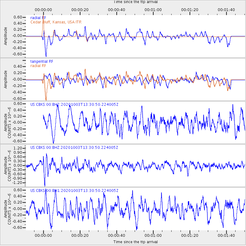
CBKS Cedar Bluff, Kansas, USA - Earthquake Result Viewer
*The percent match for this event was below the threshold and hence no stack was calculated.
| Earthquake location: |
Eastern Greenland |
| Earthquake latitude/longitude: |
69.3/-29.8 |
| Earthquake time(UTC): |
2020/10/03 (277) 13:22:47 GMT |
| Earthquake Depth: |
10 km |
| Earthquake Magnitude: |
5.3 Mww |
| Earthquake Catalog/Contributor: |
NEIC PDE/us |
|
| Network: |
US United States National Seismic Network |
| Station: |
CBKS Cedar Bluff, Kansas, USA |
| Lat/Lon: |
38.81 N/99.74 W |
| Elevation: |
677 m |
|
| Distance: |
47.3 deg |
| Az: |
267.798 deg |
| Baz: |
27.048 deg |
| Ray Param: |
$rayparam |
*The percent match for this event was below the threshold and hence was not used in the summary stack. |
|
| Radial Match: |
69.283905 % |
| Radial Bump: |
400 |
| Transverse Match: |
51.739063 % |
| Transverse Bump: |
400 |
| SOD ConfigId: |
22732711 |
| Insert Time: |
2020-10-17 13:47:22.237 +0000 |
| GWidth: |
2.5 |
| Max Bumps: |
400 |
| Tol: |
0.001 |
|
Signal To Noise
| Channel | StoN | STA | LTA |
| US:CBKS:00:BHZ:20201003T13:30:50.224005Z | 4.186014 | 5.2768604E-7 | 1.260593E-7 |
| US:CBKS:00:BH1:20201003T13:30:50.224005Z | 2.2494607 | 3.360396E-7 | 1.4938674E-7 |
| US:CBKS:00:BH2:20201003T13:30:50.224005Z | 0.8152855 | 2.2503411E-7 | 2.760188E-7 |
| Arrivals |
| Ps | |
| PpPs | |
| PsPs/PpSs | |


