You are here: Home > Network List > US - United States National Seismic Network Stations List
> Station MIAR Mount Ida, Arkansas, USA > Earthquake Result Viewer
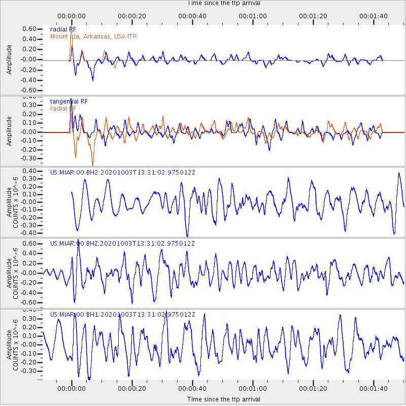
MIAR Mount Ida, Arkansas, USA - Earthquake Result Viewer
*The percent match for this event was below the threshold and hence no stack was calculated.
| Earthquake location: |
Eastern Greenland |
| Earthquake latitude/longitude: |
69.3/-29.8 |
| Earthquake time(UTC): |
2020/10/03 (277) 13:22:47 GMT |
| Earthquake Depth: |
10 km |
| Earthquake Magnitude: |
5.3 Mww |
| Earthquake Catalog/Contributor: |
NEIC PDE/us |
|
| Network: |
US United States National Seismic Network |
| Station: |
MIAR Mount Ida, Arkansas, USA |
| Lat/Lon: |
34.55 N/93.58 W |
| Elevation: |
207 m |
|
| Distance: |
48.9 deg |
| Az: |
259.305 deg |
| Baz: |
25.038 deg |
| Ray Param: |
$rayparam |
*The percent match for this event was below the threshold and hence was not used in the summary stack. |
|
| Radial Match: |
70.050224 % |
| Radial Bump: |
400 |
| Transverse Match: |
55.839455 % |
| Transverse Bump: |
400 |
| SOD ConfigId: |
22732711 |
| Insert Time: |
2020-10-17 13:47:45.378 +0000 |
| GWidth: |
2.5 |
| Max Bumps: |
400 |
| Tol: |
0.001 |
|
Signal To Noise
| Channel | StoN | STA | LTA |
| US:MIAR:00:BHZ:20201003T13:31:02.975012Z | 2.6897435 | 3.2917507E-7 | 1.2238158E-7 |
| US:MIAR:00:BH1:20201003T13:31:02.975012Z | 2.4319415 | 2.1109837E-7 | 8.68024E-8 |
| US:MIAR:00:BH2:20201003T13:31:02.975012Z | 0.57953507 | 8.3756134E-8 | 1.4452297E-7 |
| Arrivals |
| Ps | |
| PpPs | |
| PsPs/PpSs | |


