You are here: Home > Network List > TA - USArray Transportable Network (new EarthScope stations) Stations List
> Station G31M Satah River, YT, CAN > Earthquake Result Viewer
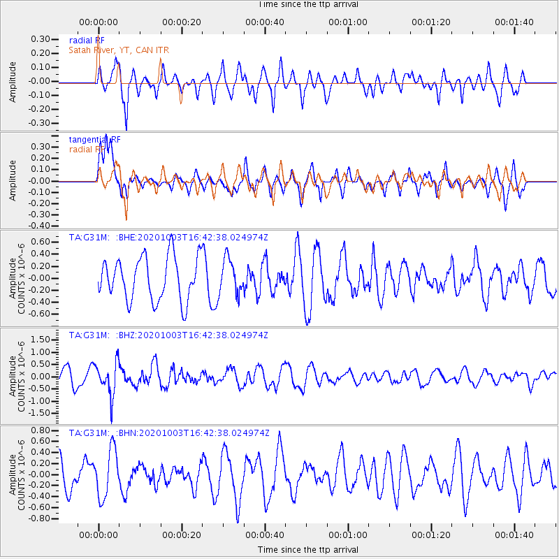
G31M Satah River, YT, CAN - Earthquake Result Viewer
*The percent match for this event was below the threshold and hence no stack was calculated.
| Earthquake location: |
New Britain Region, P.N.G. |
| Earthquake latitude/longitude: |
-7.2/150.1 |
| Earthquake time(UTC): |
2020/10/03 (277) 16:30:06 GMT |
| Earthquake Depth: |
15 km |
| Earthquake Magnitude: |
5.4 Mww |
| Earthquake Catalog/Contributor: |
NEIC PDE/us |
|
| Network: |
TA USArray Transportable Network (new EarthScope stations) |
| Station: |
G31M Satah River, YT, CAN |
| Lat/Lon: |
66.92 N/134.27 W |
| Elevation: |
61 m |
|
| Distance: |
91.0 deg |
| Az: |
22.456 deg |
| Baz: |
254.053 deg |
| Ray Param: |
$rayparam |
*The percent match for this event was below the threshold and hence was not used in the summary stack. |
|
| Radial Match: |
65.63595 % |
| Radial Bump: |
400 |
| Transverse Match: |
73.70242 % |
| Transverse Bump: |
365 |
| SOD ConfigId: |
22732711 |
| Insert Time: |
2020-10-17 16:42:15.056 +0000 |
| GWidth: |
2.5 |
| Max Bumps: |
400 |
| Tol: |
0.001 |
|
Signal To Noise
| Channel | StoN | STA | LTA |
| TA:G31M: :BHZ:20201003T16:42:38.024974Z | 1.4815394 | 6.726514E-7 | 4.5402197E-7 |
| TA:G31M: :BHN:20201003T16:42:38.024974Z | 1.2215456 | 4.468675E-7 | 3.6582136E-7 |
| TA:G31M: :BHE:20201003T16:42:38.024974Z | 0.7922337 | 2.8673634E-7 | 3.6193404E-7 |
| Arrivals |
| Ps | |
| PpPs | |
| PsPs/PpSs | |


