You are here: Home > Network List > TA - USArray Transportable Network (new EarthScope stations) Stations List
> Station I17K Unalakleet, AK, USA > Earthquake Result Viewer
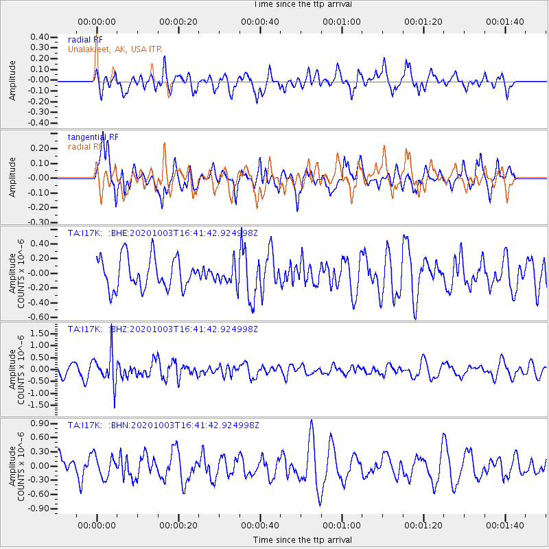
I17K Unalakleet, AK, USA - Earthquake Result Viewer
*The percent match for this event was below the threshold and hence no stack was calculated.
| Earthquake location: |
New Britain Region, P.N.G. |
| Earthquake latitude/longitude: |
-7.2/150.1 |
| Earthquake time(UTC): |
2020/10/03 (277) 16:30:06 GMT |
| Earthquake Depth: |
15 km |
| Earthquake Magnitude: |
5.4 Mww |
| Earthquake Catalog/Contributor: |
NEIC PDE/us |
|
| Network: |
TA USArray Transportable Network (new EarthScope stations) |
| Station: |
I17K Unalakleet, AK, USA |
| Lat/Lon: |
63.89 N/160.70 W |
| Elevation: |
105 m |
|
| Distance: |
79.9 deg |
| Az: |
19.905 deg |
| Baz: |
229.768 deg |
| Ray Param: |
$rayparam |
*The percent match for this event was below the threshold and hence was not used in the summary stack. |
|
| Radial Match: |
54.553104 % |
| Radial Bump: |
391 |
| Transverse Match: |
64.15235 % |
| Transverse Bump: |
374 |
| SOD ConfigId: |
22732711 |
| Insert Time: |
2020-10-17 16:42:20.096 +0000 |
| GWidth: |
2.5 |
| Max Bumps: |
400 |
| Tol: |
0.001 |
|
Signal To Noise
| Channel | StoN | STA | LTA |
| TA:I17K: :BHZ:20201003T16:41:42.924998Z | 2.795804 | 6.458395E-7 | 2.3100314E-7 |
| TA:I17K: :BHN:20201003T16:41:42.924998Z | 1.334438 | 2.2756316E-7 | 1.7053108E-7 |
| TA:I17K: :BHE:20201003T16:41:42.924998Z | 0.65573126 | 1.384353E-7 | 2.1111592E-7 |
| Arrivals |
| Ps | |
| PpPs | |
| PsPs/PpSs | |


