You are here: Home > Network List > TA - USArray Transportable Network (new EarthScope stations) Stations List
> Station G16K Koyuk River, AK, USA > Earthquake Result Viewer
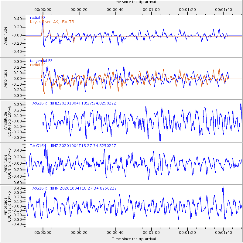
G16K Koyuk River, AK, USA - Earthquake Result Viewer
*The percent match for this event was below the threshold and hence no stack was calculated.
| Earthquake location: |
Mindoro, Philippines |
| Earthquake latitude/longitude: |
13.6/120.7 |
| Earthquake time(UTC): |
2020/10/04 (278) 18:16:55 GMT |
| Earthquake Depth: |
137 km |
| Earthquake Magnitude: |
5.6 mww |
| Earthquake Catalog/Contributor: |
NEIC PDE/us |
|
| Network: |
TA USArray Transportable Network (new EarthScope stations) |
| Station: |
G16K Koyuk River, AK, USA |
| Lat/Lon: |
65.39 N/162.35 W |
| Elevation: |
169 m |
|
| Distance: |
72.2 deg |
| Az: |
25.354 deg |
| Baz: |
263.855 deg |
| Ray Param: |
$rayparam |
*The percent match for this event was below the threshold and hence was not used in the summary stack. |
|
| Radial Match: |
59.664543 % |
| Radial Bump: |
400 |
| Transverse Match: |
55.70651 % |
| Transverse Bump: |
400 |
| SOD ConfigId: |
22732711 |
| Insert Time: |
2020-10-18 18:27:36.432 +0000 |
| GWidth: |
2.5 |
| Max Bumps: |
400 |
| Tol: |
0.001 |
|
Signal To Noise
| Channel | StoN | STA | LTA |
| TA:G16K: :BHZ:20201004T18:27:34.825022Z | 1.8690839 | 2.6898712E-7 | 1.4391388E-7 |
| TA:G16K: :BHN:20201004T18:27:34.825022Z | 1.9656343 | 1.8954381E-7 | 9.642882E-8 |
| TA:G16K: :BHE:20201004T18:27:34.825022Z | 0.9127024 | 1.0686857E-7 | 1.17090266E-7 |
| Arrivals |
| Ps | |
| PpPs | |
| PsPs/PpSs | |


