You are here: Home > Network List > GS - US Geological Survey Networks Stations List
> Station OK031 S. Brethren Rd., Cushing, OK, USA > Earthquake Result Viewer
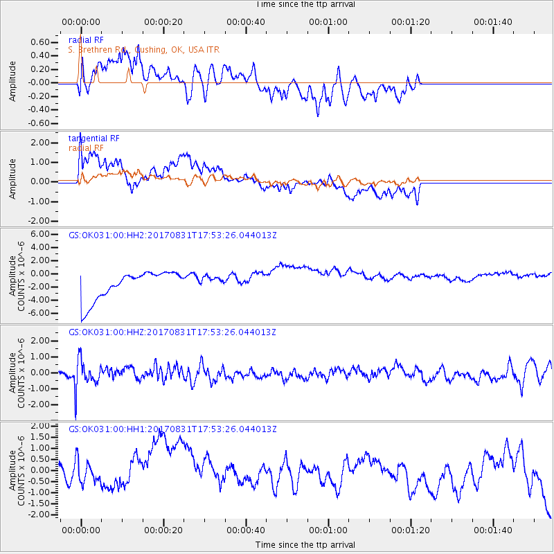
OK031 S. Brethren Rd., Cushing, OK, USA - Earthquake Result Viewer
*The percent match for this event was below the threshold and hence no stack was calculated.
| Earthquake location: |
Kodiak Island Region, Alaska |
| Earthquake latitude/longitude: |
58.5/-153.7 |
| Earthquake time(UTC): |
2017/08/31 (243) 17:46:02 GMT |
| Earthquake Depth: |
62 km |
| Earthquake Magnitude: |
5.5 ml |
| Earthquake Catalog/Contributor: |
NEIC PDE/ak |
|
| Network: |
GS US Geological Survey Networks |
| Station: |
OK031 S. Brethren Rd., Cushing, OK, USA |
| Lat/Lon: |
35.95 N/96.84 W |
| Elevation: |
290 m |
|
| Distance: |
43.1 deg |
| Az: |
95.924 deg |
| Baz: |
319.867 deg |
| Ray Param: |
$rayparam |
*The percent match for this event was below the threshold and hence was not used in the summary stack. |
|
| Radial Match: |
65.5502 % |
| Radial Bump: |
400 |
| Transverse Match: |
48.043945 % |
| Transverse Bump: |
400 |
| SOD ConfigId: |
2307692 |
| Insert Time: |
2017-09-14 17:51:47.288 +0000 |
| GWidth: |
2.5 |
| Max Bumps: |
400 |
| Tol: |
0.001 |
|
Signal To Noise
| Channel | StoN | STA | LTA |
| GS:OK031:00:HHZ:20170831T17:53:26.044013Z | 2.9924488 | 7.210204E-7 | 2.409466E-7 |
| GS:OK031:00:HH1:20170831T17:53:26.044013Z | 1.0670935 | 1.4562759E-6 | 1.3647125E-6 |
| GS:OK031:00:HH2:20170831T17:53:26.044013Z | 0.4265707 | 9.119372E-7 | 2.1378335E-6 |
| Arrivals |
| Ps | |
| PpPs | |
| PsPs/PpSs | |


