You are here: Home > Network List > US - United States National Seismic Network Stations List
> Station AMTX Amarillo, Texas, USA > Earthquake Result Viewer
AMTX Amarillo, Texas, USA - Earthquake Result Viewer
*The percent match for this event was below the threshold and hence no stack was calculated.
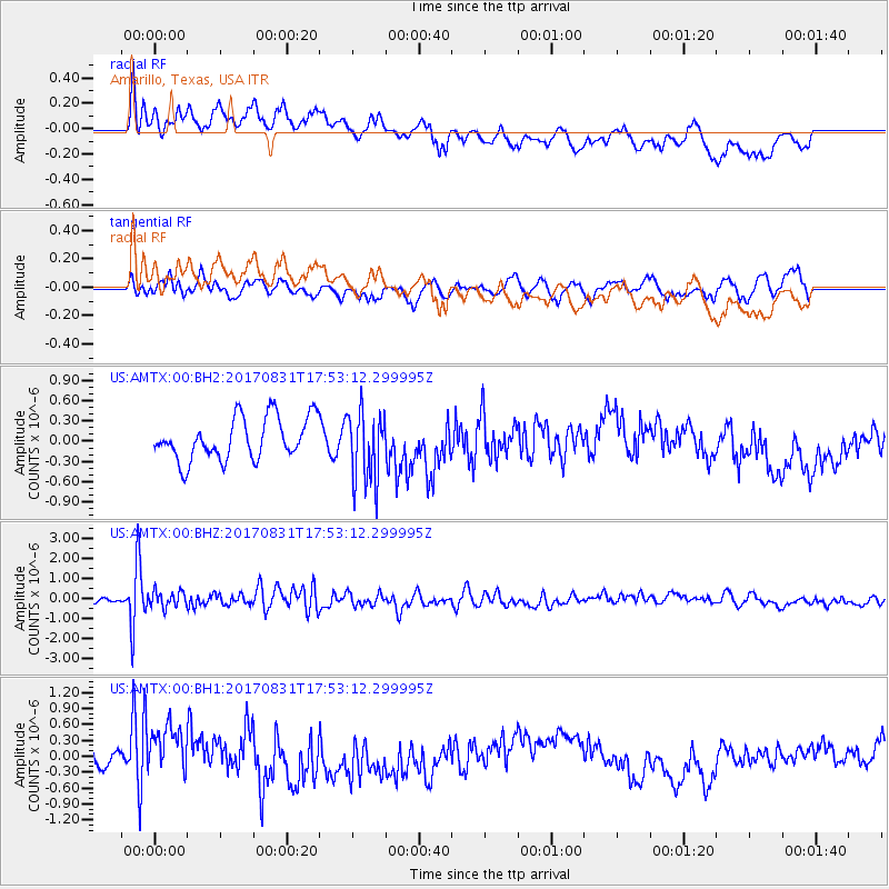
| Earthquake location: |
Kodiak Island Region, Alaska |
| Earthquake latitude/longitude: |
58.5/-153.7 |
| Earthquake time(UTC): |
2017/08/31 (243) 17:46:02 GMT |
| Earthquake Depth: |
62 km |
| Earthquake Magnitude: |
5.5 ml |
| Earthquake Catalog/Contributor: |
NEIC PDE/ak |
|
| Network: |
US United States National Seismic Network |
| Station: |
AMTX Amarillo, Texas, USA |
| Lat/Lon: |
34.53 N/101.41 W |
| Elevation: |
1010 m |
|
| Distance: |
41.8 deg |
| Az: |
101.546 deg |
| Baz: |
321.394 deg |
| Ray Param: |
$rayparam |
*The percent match for this event was below the threshold and hence was not used in the summary stack. |
|
| Radial Match: |
60.03155 % |
| Radial Bump: |
400 |
| Transverse Match: |
53.199593 % |
| Transverse Bump: |
400 |
| SOD ConfigId: |
2307692 |
| Insert Time: |
2017-09-14 17:53:49.098 +0000 |
| GWidth: |
2.5 |
| Max Bumps: |
400 |
| Tol: |
0.001 |
|
Signal To Noise
| Channel | StoN | STA | LTA |
| US:AMTX:00:BHZ:20170831T17:53:12.299995Z | 2.1643236 | 4.1656295E-7 | 1.9246797E-7 |
| US:AMTX:00:BH1:20170831T17:53:12.299995Z | 2.357328 | 5.193221E-7 | 2.2030116E-7 |
| US:AMTX:00:BH2:20170831T17:53:12.299995Z | 1.4502394 | 4.6215212E-7 | 3.18673E-7 |
| Arrivals |
| Ps | |
| PpPs | |
| PsPs/PpSs | |


