You are here: Home > Network List > US - United States National Seismic Network Stations List
> Station VBMS Vicksburg, Mississippi > Earthquake Result Viewer
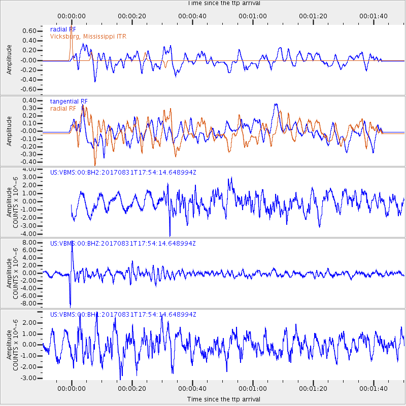
VBMS Vicksburg, Mississippi - Earthquake Result Viewer
*The percent match for this event was below the threshold and hence no stack was calculated.
| Earthquake location: |
Kodiak Island Region, Alaska |
| Earthquake latitude/longitude: |
58.5/-153.7 |
| Earthquake time(UTC): |
2017/08/31 (243) 17:46:02 GMT |
| Earthquake Depth: |
62 km |
| Earthquake Magnitude: |
5.5 ml |
| Earthquake Catalog/Contributor: |
NEIC PDE/ak |
|
| Network: |
US United States National Seismic Network |
| Station: |
VBMS Vicksburg, Mississippi |
| Lat/Lon: |
32.22 N/90.52 W |
| Elevation: |
16 m |
|
| Distance: |
49.3 deg |
| Az: |
93.547 deg |
| Baz: |
321.749 deg |
| Ray Param: |
$rayparam |
*The percent match for this event was below the threshold and hence was not used in the summary stack. |
|
| Radial Match: |
57.799255 % |
| Radial Bump: |
400 |
| Transverse Match: |
47.709465 % |
| Transverse Bump: |
400 |
| SOD ConfigId: |
2307692 |
| Insert Time: |
2017-09-14 17:54:33.810 +0000 |
| GWidth: |
2.5 |
| Max Bumps: |
400 |
| Tol: |
0.001 |
|
Signal To Noise
| Channel | StoN | STA | LTA |
| US:VBMS:00:BHZ:20170831T17:54:14.648994Z | 9.221852 | 3.0174094E-6 | 3.272021E-7 |
| US:VBMS:00:BH1:20170831T17:54:14.648994Z | 1.948478 | 1.2013892E-6 | 6.165783E-7 |
| US:VBMS:00:BH2:20170831T17:54:14.648994Z | 1.3140918 | 1.1977505E-6 | 9.1146643E-7 |
| Arrivals |
| Ps | |
| PpPs | |
| PsPs/PpSs | |


