You are here: Home > Network List > US - United States National Seismic Network Stations List
> Station DGMT Dagmar, Montana, USA > Earthquake Result Viewer
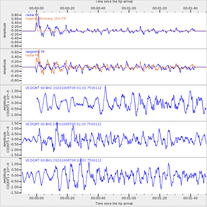
DGMT Dagmar, Montana, USA - Earthquake Result Viewer
*The percent match for this event was below the threshold and hence no stack was calculated.
| Earthquake location: |
South Of Alaska |
| Earthquake latitude/longitude: |
54.8/-159.9 |
| Earthquake time(UTC): |
2020/10/06 (280) 05:54:50 GMT |
| Earthquake Depth: |
30 km |
| Earthquake Magnitude: |
5.6 ml |
| Earthquake Catalog/Contributor: |
NEIC PDE/us |
|
| Network: |
US United States National Seismic Network |
| Station: |
DGMT Dagmar, Montana, USA |
| Lat/Lon: |
48.47 N/104.20 W |
| Elevation: |
0.0 m |
|
| Distance: |
34.3 deg |
| Az: |
77.137 deg |
| Baz: |
302.083 deg |
| Ray Param: |
$rayparam |
*The percent match for this event was below the threshold and hence was not used in the summary stack. |
|
| Radial Match: |
70.90074 % |
| Radial Bump: |
317 |
| Transverse Match: |
54.93502 % |
| Transverse Bump: |
400 |
| SOD ConfigId: |
22732711 |
| Insert Time: |
2020-10-20 06:15:27.329 +0000 |
| GWidth: |
2.5 |
| Max Bumps: |
400 |
| Tol: |
0.001 |
|
Signal To Noise
| Channel | StoN | STA | LTA |
| US:DGMT:00:BHZ:20201006T06:01:03.750011Z | 2.101372 | 4.5241038E-7 | 2.1529286E-7 |
| US:DGMT:00:BH1:20201006T06:01:03.750011Z | 1.3035998 | 4.0793066E-7 | 3.129263E-7 |
| US:DGMT:00:BH2:20201006T06:01:03.750011Z | 0.6873752 | 2.9236315E-7 | 4.253327E-7 |
| Arrivals |
| Ps | |
| PpPs | |
| PsPs/PpSs | |


