You are here: Home > Network List > US - United States National Seismic Network Stations List
> Station EGMT Eagleton, Montana, USA > Earthquake Result Viewer
EGMT Eagleton, Montana, USA - Earthquake Result Viewer
*The percent match for this event was below the threshold and hence no stack was calculated.
| Earthquake location: |
South Of Alaska |
| Earthquake latitude/longitude: |
54.8/-159.9 |
| Earthquake time(UTC): |
2020/10/06 (280) 05:54:50 GMT |
| Earthquake Depth: |
30 km |
| Earthquake Magnitude: |
5.6 ml |
| Earthquake Catalog/Contributor: |
NEIC PDE/us |
|
| Network: |
US United States National Seismic Network |
| Station: |
EGMT Eagleton, Montana, USA |
| Lat/Lon: |
48.02 N/109.75 W |
| Elevation: |
1055 m |
|
| Distance: |
31.4 deg |
| Az: |
81.447 deg |
| Baz: |
301.569 deg |
| Ray Param: |
$rayparam |
*The percent match for this event was below the threshold and hence was not used in the summary stack. |
|
| Radial Match: |
57.06149 % |
| Radial Bump: |
400 |
| Transverse Match: |
64.26225 % |
| Transverse Bump: |
400 |
| SOD ConfigId: |
22732711 |
| Insert Time: |
2020-10-20 06:15:33.052 +0000 |
| GWidth: |
2.5 |
| Max Bumps: |
400 |
| Tol: |
0.001 |
|
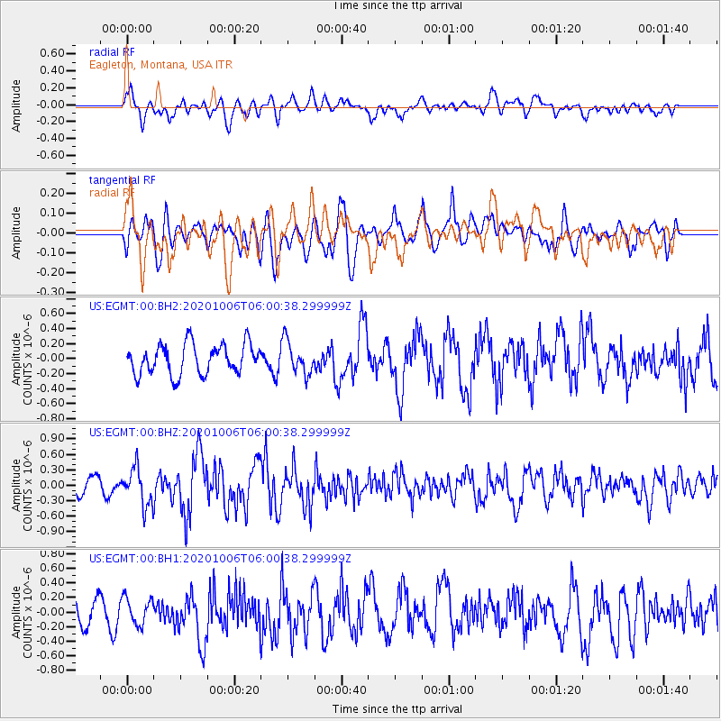
Signal To Noise
| Channel | StoN | STA | LTA |
| US:EGMT:00:BHZ:20201006T06:00:38.299999Z | 2.0787964 | 3.6209485E-7 | 1.7418486E-7 |
| US:EGMT:00:BH1:20201006T06:00:38.299999Z | 1.032202 | 1.8149564E-7 | 1.7583343E-7 |
| US:EGMT:00:BH2:20201006T06:00:38.299999Z | 1.1002955 | 2.2064421E-7 | 2.0053176E-7 |
| Arrivals |
| Ps | |
| PpPs | |
| PsPs/PpSs | |


