You are here: Home > Network List > AV - Alaska Volcano Observatory Stations List
> Station PLBL Mt. Peulik Volcano, Alaska > Earthquake Result Viewer
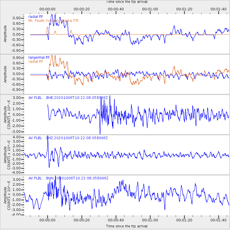
PLBL Mt. Peulik Volcano, Alaska - Earthquake Result Viewer
*The percent match for this event was below the threshold and hence no stack was calculated.
| Earthquake location: |
Fiji Islands Region |
| Earthquake latitude/longitude: |
-18.0/-178.5 |
| Earthquake time(UTC): |
2020/10/06 (280) 10:11:46 GMT |
| Earthquake Depth: |
629 km |
| Earthquake Magnitude: |
6.0 Mww |
| Earthquake Catalog/Contributor: |
NEIC PDE/us |
|
| Network: |
AV Alaska Volcano Observatory |
| Station: |
PLBL Mt. Peulik Volcano, Alaska |
| Lat/Lon: |
57.70 N/156.82 W |
| Elevation: |
461 m |
|
| Distance: |
77.6 deg |
| Az: |
11.714 deg |
| Baz: |
201.088 deg |
| Ray Param: |
$rayparam |
*The percent match for this event was below the threshold and hence was not used in the summary stack. |
|
| Radial Match: |
34.96733 % |
| Radial Bump: |
400 |
| Transverse Match: |
57.58037 % |
| Transverse Bump: |
400 |
| SOD ConfigId: |
22732711 |
| Insert Time: |
2020-10-20 10:19:24.558 +0000 |
| GWidth: |
2.5 |
| Max Bumps: |
400 |
| Tol: |
0.001 |
|
Signal To Noise
| Channel | StoN | STA | LTA |
| AV:PLBL: :BHZ:20201006T10:22:08.058996Z | 4.068866 | 1.5033797E-6 | 3.6948376E-7 |
| AV:PLBL: :BHN:20201006T10:22:08.058996Z | 0.93486243 | 1.3088111E-6 | 1.400004E-6 |
| AV:PLBL: :BHE:20201006T10:22:08.058996Z | 2.3255954 | 1.3754211E-6 | 5.914275E-7 |
| Arrivals |
| Ps | |
| PpPs | |
| PsPs/PpSs | |


