You are here: Home > Network List > GS - US Geological Survey Networks Stations List
> Station OK051 E0350 and S34600 Roads, Ralston, OK > Earthquake Result Viewer
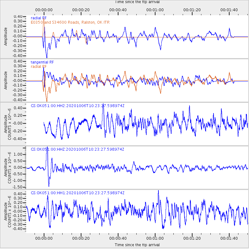
OK051 E0350 and S34600 Roads, Ralston, OK - Earthquake Result Viewer
*The percent match for this event was below the threshold and hence no stack was calculated.
| Earthquake location: |
Fiji Islands Region |
| Earthquake latitude/longitude: |
-18.0/-178.5 |
| Earthquake time(UTC): |
2020/10/06 (280) 10:11:46 GMT |
| Earthquake Depth: |
629 km |
| Earthquake Magnitude: |
6.0 Mww |
| Earthquake Catalog/Contributor: |
NEIC PDE/us |
|
| Network: |
GS US Geological Survey Networks |
| Station: |
OK051 E0350 and S34600 Roads, Ralston, OK |
| Lat/Lon: |
36.51 N/96.84 W |
| Elevation: |
263 m |
|
| Distance: |
94.1 deg |
| Az: |
53.053 deg |
| Baz: |
250.705 deg |
| Ray Param: |
$rayparam |
*The percent match for this event was below the threshold and hence was not used in the summary stack. |
|
| Radial Match: |
69.63552 % |
| Radial Bump: |
400 |
| Transverse Match: |
55.689674 % |
| Transverse Bump: |
400 |
| SOD ConfigId: |
22732711 |
| Insert Time: |
2020-10-20 10:26:39.732 +0000 |
| GWidth: |
2.5 |
| Max Bumps: |
400 |
| Tol: |
0.001 |
|
Signal To Noise
| Channel | StoN | STA | LTA |
| GS:OK051:00:HHZ:20201006T10:23:27.598974Z | 6.360242 | 7.251665E-7 | 1.14015556E-7 |
| GS:OK051:00:HH1:20201006T10:23:27.598974Z | 1.8376473 | 2.1632484E-7 | 1.17718365E-7 |
| GS:OK051:00:HH2:20201006T10:23:27.598974Z | 1.6394341 | 2.469566E-7 | 1.5063526E-7 |
| Arrivals |
| Ps | |
| PpPs | |
| PsPs/PpSs | |


