You are here: Home > Network List > TA - USArray Transportable Network (new EarthScope stations) Stations List
> Station D23K Nanushuk River, AK USA > Earthquake Result Viewer
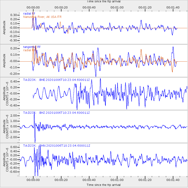
D23K Nanushuk River, AK USA - Earthquake Result Viewer
*The percent match for this event was below the threshold and hence no stack was calculated.
| Earthquake location: |
Fiji Islands Region |
| Earthquake latitude/longitude: |
-18.0/-178.5 |
| Earthquake time(UTC): |
2020/10/06 (280) 10:11:46 GMT |
| Earthquake Depth: |
629 km |
| Earthquake Magnitude: |
6.0 Mww |
| Earthquake Catalog/Contributor: |
NEIC PDE/us |
|
| Network: |
TA USArray Transportable Network (new EarthScope stations) |
| Station: |
D23K Nanushuk River, AK USA |
| Lat/Lon: |
68.97 N/150.68 W |
| Elevation: |
406 m |
|
| Distance: |
89.0 deg |
| Az: |
9.698 deg |
| Baz: |
206.359 deg |
| Ray Param: |
$rayparam |
*The percent match for this event was below the threshold and hence was not used in the summary stack. |
|
| Radial Match: |
59.774513 % |
| Radial Bump: |
390 |
| Transverse Match: |
58.50127 % |
| Transverse Bump: |
400 |
| SOD ConfigId: |
22732711 |
| Insert Time: |
2020-10-20 10:34:48.340 +0000 |
| GWidth: |
2.5 |
| Max Bumps: |
400 |
| Tol: |
0.001 |
|
Signal To Noise
| Channel | StoN | STA | LTA |
| TA:D23K: :BHZ:20201006T10:23:04.600011Z | 6.233689 | 9.672501E-7 | 1.5516497E-7 |
| TA:D23K: :BHN:20201006T10:23:04.600011Z | 2.562486 | 3.4086648E-7 | 1.330218E-7 |
| TA:D23K: :BHE:20201006T10:23:04.600011Z | 2.0314734 | 2.4174065E-7 | 1.189977E-7 |
| Arrivals |
| Ps | |
| PpPs | |
| PsPs/PpSs | |


