You are here: Home > Network List > TA - USArray Transportable Network (new EarthScope stations) Stations List
> Station E20K Nigu River, AK, USA > Earthquake Result Viewer
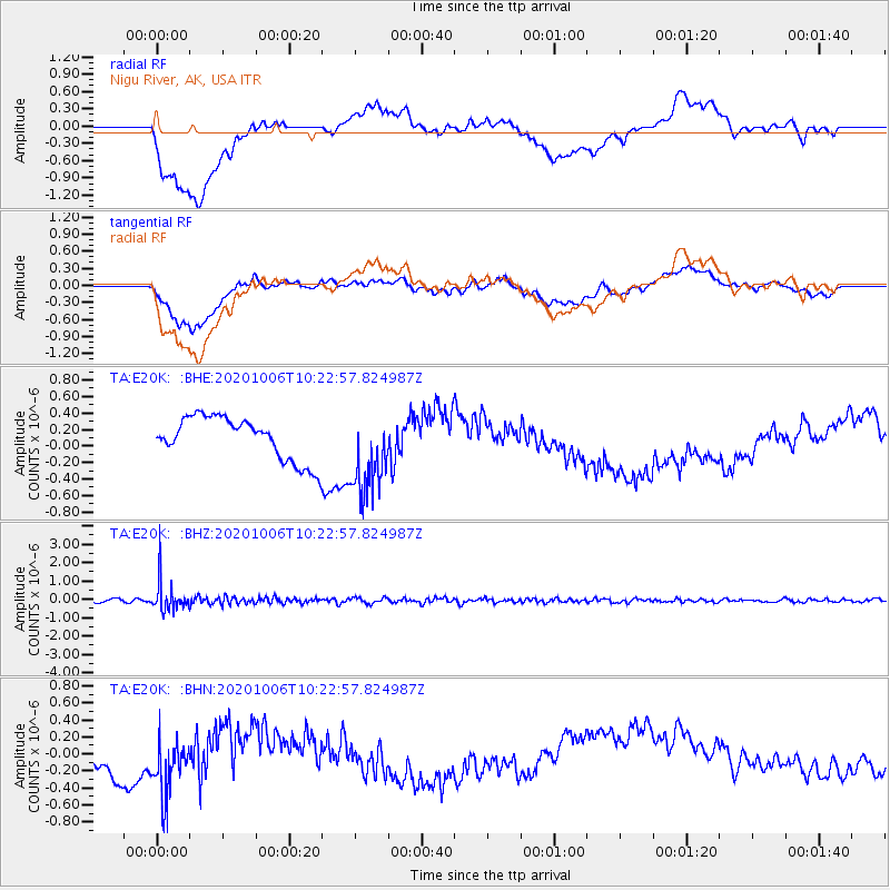
E20K Nigu River, AK, USA - Earthquake Result Viewer
*The percent match for this event was below the threshold and hence no stack was calculated.
| Earthquake location: |
Fiji Islands Region |
| Earthquake latitude/longitude: |
-18.0/-178.5 |
| Earthquake time(UTC): |
2020/10/06 (280) 10:11:46 GMT |
| Earthquake Depth: |
629 km |
| Earthquake Magnitude: |
6.0 Mww |
| Earthquake Catalog/Contributor: |
NEIC PDE/us |
|
| Network: |
TA USArray Transportable Network (new EarthScope stations) |
| Station: |
E20K Nigu River, AK, USA |
| Lat/Lon: |
68.26 N/156.19 W |
| Elevation: |
866 m |
|
| Distance: |
87.6 deg |
| Az: |
8.136 deg |
| Baz: |
201.188 deg |
| Ray Param: |
$rayparam |
*The percent match for this event was below the threshold and hence was not used in the summary stack. |
|
| Radial Match: |
29.296808 % |
| Radial Bump: |
400 |
| Transverse Match: |
25.75781 % |
| Transverse Bump: |
400 |
| SOD ConfigId: |
22732711 |
| Insert Time: |
2020-10-20 10:34:51.505 +0000 |
| GWidth: |
2.5 |
| Max Bumps: |
400 |
| Tol: |
0.001 |
|
Signal To Noise
| Channel | StoN | STA | LTA |
| TA:E20K: :BHZ:20201006T10:22:57.824987Z | 9.413445 | 7.8385983E-7 | 8.327024E-8 |
| TA:E20K: :BHN:20201006T10:22:57.824987Z | 1.5303749 | 3.6798625E-7 | 2.4045497E-7 |
| TA:E20K: :BHE:20201006T10:22:57.824987Z | 1.9909936 | 5.1906886E-7 | 2.6070845E-7 |
| Arrivals |
| Ps | |
| PpPs | |
| PsPs/PpSs | |


