You are here: Home > Network List > TA - USArray Transportable Network (new EarthScope stations) Stations List
> Station O17K Koliganek, Bristol Bay, AK, USA > Earthquake Result Viewer
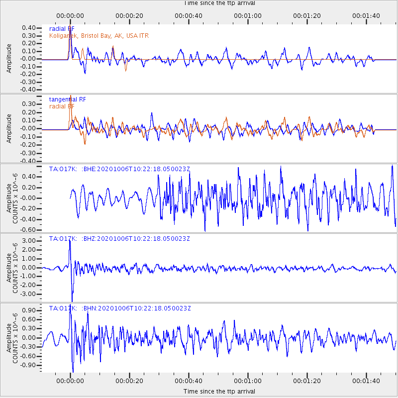
O17K Koliganek, Bristol Bay, AK, USA - Earthquake Result Viewer
*The percent match for this event was below the threshold and hence no stack was calculated.
| Earthquake location: |
Fiji Islands Region |
| Earthquake latitude/longitude: |
-18.0/-178.5 |
| Earthquake time(UTC): |
2020/10/06 (280) 10:11:46 GMT |
| Earthquake Depth: |
629 km |
| Earthquake Magnitude: |
6.0 Mww |
| Earthquake Catalog/Contributor: |
NEIC PDE/us |
|
| Network: |
TA USArray Transportable Network (new EarthScope stations) |
| Station: |
O17K Koliganek, Bristol Bay, AK, USA |
| Lat/Lon: |
59.77 N/157.09 W |
| Elevation: |
156 m |
|
| Distance: |
79.5 deg |
| Az: |
10.821 deg |
| Baz: |
200.676 deg |
| Ray Param: |
$rayparam |
*The percent match for this event was below the threshold and hence was not used in the summary stack. |
|
| Radial Match: |
63.219387 % |
| Radial Bump: |
368 |
| Transverse Match: |
68.54525 % |
| Transverse Bump: |
371 |
| SOD ConfigId: |
22732711 |
| Insert Time: |
2020-10-20 10:36:16.487 +0000 |
| GWidth: |
2.5 |
| Max Bumps: |
400 |
| Tol: |
0.001 |
|
Signal To Noise
| Channel | StoN | STA | LTA |
| TA:O17K: :BHZ:20201006T10:22:18.050023Z | 11.641156 | 1.3908211E-6 | 1.1947448E-7 |
| TA:O17K: :BHN:20201006T10:22:18.050023Z | 3.6603408 | 5.2661807E-7 | 1.4387132E-7 |
| TA:O17K: :BHE:20201006T10:22:18.050023Z | 1.6780782 | 2.1447698E-7 | 1.2781108E-7 |
| Arrivals |
| Ps | |
| PpPs | |
| PsPs/PpSs | |


