You are here: Home > Network List > US - United States National Seismic Network Stations List
> Station AMTX Amarillo, Texas, USA > Earthquake Result Viewer
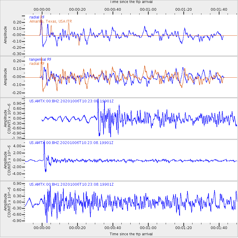
AMTX Amarillo, Texas, USA - Earthquake Result Viewer
*The percent match for this event was below the threshold and hence no stack was calculated.
| Earthquake location: |
Fiji Islands Region |
| Earthquake latitude/longitude: |
-18.0/-178.5 |
| Earthquake time(UTC): |
2020/10/06 (280) 10:11:46 GMT |
| Earthquake Depth: |
629 km |
| Earthquake Magnitude: |
6.0 Mww |
| Earthquake Catalog/Contributor: |
NEIC PDE/us |
|
| Network: |
US United States National Seismic Network |
| Station: |
AMTX Amarillo, Texas, USA |
| Lat/Lon: |
34.53 N/101.41 W |
| Elevation: |
1010 m |
|
| Distance: |
89.9 deg |
| Az: |
53.582 deg |
| Baz: |
248.041 deg |
| Ray Param: |
$rayparam |
*The percent match for this event was below the threshold and hence was not used in the summary stack. |
|
| Radial Match: |
72.305725 % |
| Radial Bump: |
400 |
| Transverse Match: |
58.35341 % |
| Transverse Bump: |
400 |
| SOD ConfigId: |
22732711 |
| Insert Time: |
2020-10-20 10:39:32.226 +0000 |
| GWidth: |
2.5 |
| Max Bumps: |
400 |
| Tol: |
0.001 |
|
Signal To Noise
| Channel | StoN | STA | LTA |
| US:AMTX:00:BHZ:20201006T10:23:08.19901Z | 15.383062 | 1.7615928E-6 | 1.1451509E-7 |
| US:AMTX:00:BH1:20201006T10:23:08.19901Z | 3.2868643 | 3.6801168E-7 | 1.11964376E-7 |
| US:AMTX:00:BH2:20201006T10:23:08.19901Z | 5.9807963 | 5.2338595E-7 | 8.7511076E-8 |
| Arrivals |
| Ps | |
| PpPs | |
| PsPs/PpSs | |


