You are here: Home > Network List > US - United States National Seismic Network Stations List
> Station MSO Missoula, Montana, USA > Earthquake Result Viewer
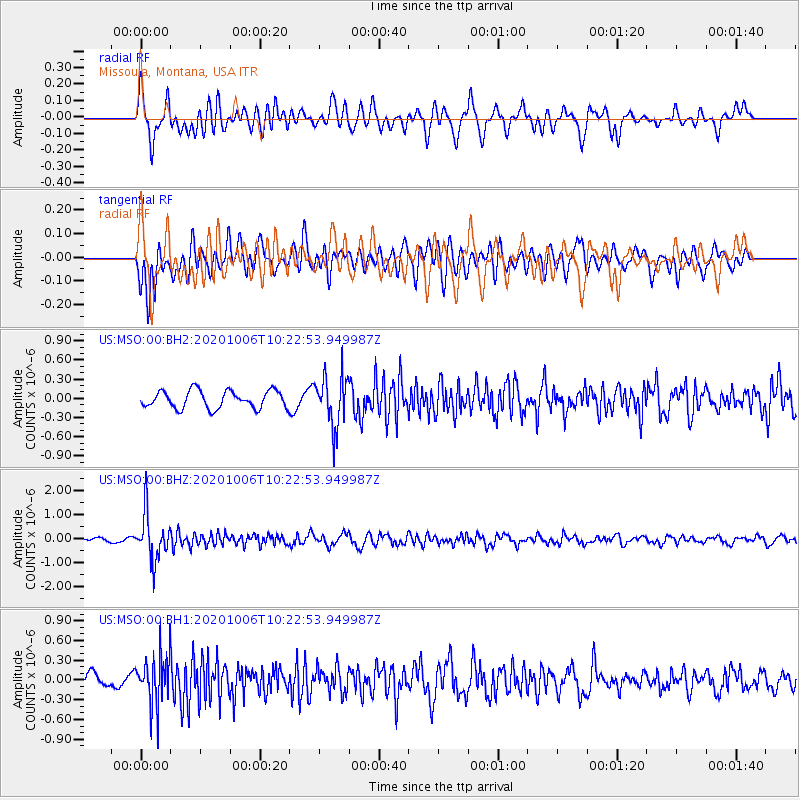
MSO Missoula, Montana, USA - Earthquake Result Viewer
*The percent match for this event was below the threshold and hence no stack was calculated.
| Earthquake location: |
Fiji Islands Region |
| Earthquake latitude/longitude: |
-18.0/-178.5 |
| Earthquake time(UTC): |
2020/10/06 (280) 10:11:46 GMT |
| Earthquake Depth: |
629 km |
| Earthquake Magnitude: |
6.0 Mww |
| Earthquake Catalog/Contributor: |
NEIC PDE/us |
|
| Network: |
US United States National Seismic Network |
| Station: |
MSO Missoula, Montana, USA |
| Lat/Lon: |
46.83 N/113.94 W |
| Elevation: |
1264 m |
|
| Distance: |
86.7 deg |
| Az: |
38.389 deg |
| Baz: |
239.384 deg |
| Ray Param: |
$rayparam |
*The percent match for this event was below the threshold and hence was not used in the summary stack. |
|
| Radial Match: |
73.943535 % |
| Radial Bump: |
400 |
| Transverse Match: |
64.42632 % |
| Transverse Bump: |
400 |
| SOD ConfigId: |
22732711 |
| Insert Time: |
2020-10-20 10:40:00.107 +0000 |
| GWidth: |
2.5 |
| Max Bumps: |
400 |
| Tol: |
0.001 |
|
Signal To Noise
| Channel | StoN | STA | LTA |
| US:MSO:00:BHZ:20201006T10:22:53.949987Z | 6.81651 | 9.617587E-7 | 1.4109254E-7 |
| US:MSO:00:BH1:20201006T10:22:53.949987Z | 2.696444 | 3.718644E-7 | 1.3790918E-7 |
| US:MSO:00:BH2:20201006T10:22:53.949987Z | 2.8785944 | 3.9386956E-7 | 1.3682704E-7 |
| Arrivals |
| Ps | |
| PpPs | |
| PsPs/PpSs | |


