You are here: Home > Network List > US - United States National Seismic Network Stations List
> Station WMOK Wichita Mountains, Oklahoma, USA > Earthquake Result Viewer
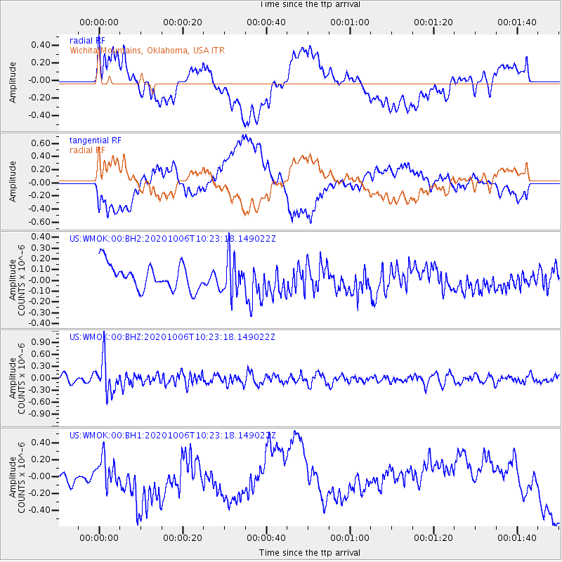
WMOK Wichita Mountains, Oklahoma, USA - Earthquake Result Viewer
*The percent match for this event was below the threshold and hence no stack was calculated.
| Earthquake location: |
Fiji Islands Region |
| Earthquake latitude/longitude: |
-18.0/-178.5 |
| Earthquake time(UTC): |
2020/10/06 (280) 10:11:46 GMT |
| Earthquake Depth: |
629 km |
| Earthquake Magnitude: |
6.0 Mww |
| Earthquake Catalog/Contributor: |
NEIC PDE/us |
|
| Network: |
US United States National Seismic Network |
| Station: |
WMOK Wichita Mountains, Oklahoma, USA |
| Lat/Lon: |
34.74 N/98.78 W |
| Elevation: |
486 m |
|
| Distance: |
92.0 deg |
| Az: |
54.173 deg |
| Baz: |
249.518 deg |
| Ray Param: |
$rayparam |
*The percent match for this event was below the threshold and hence was not used in the summary stack. |
|
| Radial Match: |
41.61524 % |
| Radial Bump: |
400 |
| Transverse Match: |
38.36922 % |
| Transverse Bump: |
400 |
| SOD ConfigId: |
22732711 |
| Insert Time: |
2020-10-20 10:40:12.257 +0000 |
| GWidth: |
2.5 |
| Max Bumps: |
400 |
| Tol: |
0.001 |
|
Signal To Noise
| Channel | StoN | STA | LTA |
| US:WMOK:00:BHZ:20201006T10:23:18.149022Z | 5.9940004 | 4.10597E-7 | 6.8501336E-8 |
| US:WMOK:00:BH1:20201006T10:23:18.149022Z | 0.56701744 | 1.5712399E-7 | 2.7710612E-7 |
| US:WMOK:00:BH2:20201006T10:23:18.149022Z | 1.4324414 | 1.6335619E-7 | 1.14040404E-7 |
| Arrivals |
| Ps | |
| PpPs | |
| PsPs/PpSs | |


