You are here: Home > Network List > UU - University of Utah Regional Network Stations List
> Station FORU South Mineral Mountains, UT, USA > Earthquake Result Viewer
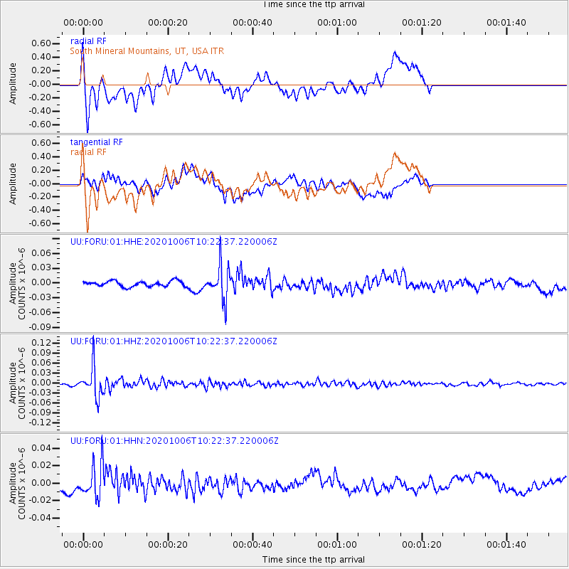
FORU South Mineral Mountains, UT, USA - Earthquake Result Viewer
*The percent match for this event was below the threshold and hence no stack was calculated.
| Earthquake location: |
Fiji Islands Region |
| Earthquake latitude/longitude: |
-18.0/-178.5 |
| Earthquake time(UTC): |
2020/10/06 (280) 10:11:46 GMT |
| Earthquake Depth: |
629 km |
| Earthquake Magnitude: |
6.0 Mww |
| Earthquake Catalog/Contributor: |
NEIC PDE/us |
|
| Network: |
UU University of Utah Regional Network |
| Station: |
FORU South Mineral Mountains, UT, USA |
| Lat/Lon: |
38.46 N/112.86 W |
| Elevation: |
1840 m |
|
| Distance: |
83.2 deg |
| Az: |
46.066 deg |
| Baz: |
240.788 deg |
| Ray Param: |
$rayparam |
*The percent match for this event was below the threshold and hence was not used in the summary stack. |
|
| Radial Match: |
67.156845 % |
| Radial Bump: |
400 |
| Transverse Match: |
54.531433 % |
| Transverse Bump: |
400 |
| SOD ConfigId: |
22732711 |
| Insert Time: |
2020-10-20 10:40:34.114 +0000 |
| GWidth: |
2.5 |
| Max Bumps: |
400 |
| Tol: |
0.001 |
|
Signal To Noise
| Channel | StoN | STA | LTA |
| UU:FORU:01:HHZ:20201006T10:22:37.220006Z | 12.799909 | 4.5642608E-8 | 3.565854E-9 |
| UU:FORU:01:HHN:20201006T10:22:37.220006Z | 3.4527514 | 1.9605318E-8 | 5.6781726E-9 |
| UU:FORU:01:HHE:20201006T10:22:37.220006Z | 6.236186 | 3.503245E-8 | 5.617608E-9 |
| Arrivals |
| Ps | |
| PpPs | |
| PsPs/PpSs | |


