You are here: Home > Network List > UW - Pacific Northwest Regional Seismic Network Stations List
> Station LCCR Mulino, OR, USA > Earthquake Result Viewer
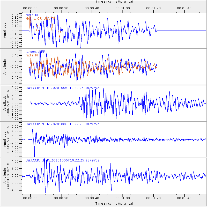
LCCR Mulino, OR, USA - Earthquake Result Viewer
*The percent match for this event was below the threshold and hence no stack was calculated.
| Earthquake location: |
Fiji Islands Region |
| Earthquake latitude/longitude: |
-18.0/-178.5 |
| Earthquake time(UTC): |
2020/10/06 (280) 10:11:46 GMT |
| Earthquake Depth: |
629 km |
| Earthquake Magnitude: |
6.0 Mww |
| Earthquake Catalog/Contributor: |
NEIC PDE/us |
|
| Network: |
UW Pacific Northwest Regional Seismic Network |
| Station: |
LCCR Mulino, OR, USA |
| Lat/Lon: |
45.21 N/122.48 W |
| Elevation: |
273 m |
|
| Distance: |
80.9 deg |
| Az: |
36.418 deg |
| Baz: |
233.041 deg |
| Ray Param: |
$rayparam |
*The percent match for this event was below the threshold and hence was not used in the summary stack. |
|
| Radial Match: |
79.61171 % |
| Radial Bump: |
400 |
| Transverse Match: |
74.02076 % |
| Transverse Bump: |
400 |
| SOD ConfigId: |
22732711 |
| Insert Time: |
2020-10-20 10:41:43.593 +0000 |
| GWidth: |
2.5 |
| Max Bumps: |
400 |
| Tol: |
0.001 |
|
Signal To Noise
| Channel | StoN | STA | LTA |
| UW:LCCR: :HHZ:20201006T10:22:25.387975Z | 18.095655 | 2.5380978E-6 | 1.4026007E-7 |
| UW:LCCR: :HHN:20201006T10:22:25.387975Z | 4.838148 | 1.0063424E-6 | 2.0800157E-7 |
| UW:LCCR: :HHE:20201006T10:22:25.387975Z | 4.005222 | 8.081262E-7 | 2.0176815E-7 |
| Arrivals |
| Ps | |
| PpPs | |
| PsPs/PpSs | |


