You are here: Home > Network List > TA - USArray Transportable Network (new EarthScope stations) Stations List
> Station D23K Nanushuk River, AK USA > Earthquake Result Viewer
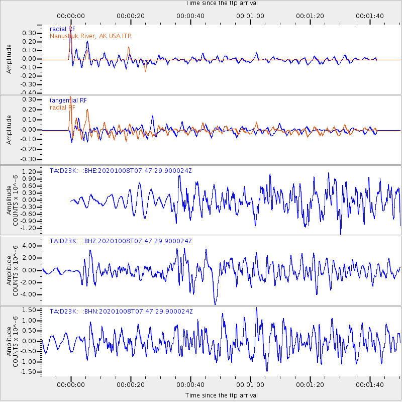
D23K Nanushuk River, AK USA - Earthquake Result Viewer
*The percent match for this event was below the threshold and hence no stack was calculated.
| Earthquake location: |
Eastern New Guinea Reg., P.N.G. |
| Earthquake latitude/longitude: |
-6.1/146.2 |
| Earthquake time(UTC): |
2020/10/08 (282) 07:35:32 GMT |
| Earthquake Depth: |
116 km |
| Earthquake Magnitude: |
6.7 Mi |
| Earthquake Catalog/Contributor: |
NEIC PDE/at |
|
| Network: |
TA USArray Transportable Network (new EarthScope stations) |
| Station: |
D23K Nanushuk River, AK USA |
| Lat/Lon: |
68.97 N/150.68 W |
| Elevation: |
406 m |
|
| Distance: |
86.3 deg |
| Az: |
18.819 deg |
| Baz: |
242.682 deg |
| Ray Param: |
$rayparam |
*The percent match for this event was below the threshold and hence was not used in the summary stack. |
|
| Radial Match: |
74.439896 % |
| Radial Bump: |
385 |
| Transverse Match: |
60.410324 % |
| Transverse Bump: |
400 |
| SOD ConfigId: |
22732711 |
| Insert Time: |
2020-10-22 07:46:44.444 +0000 |
| GWidth: |
2.5 |
| Max Bumps: |
400 |
| Tol: |
0.001 |
|
Signal To Noise
| Channel | StoN | STA | LTA |
| TA:D23K: :BHZ:20201008T07:47:29.900024Z | 2.5714931 | 8.0377623E-7 | 3.1257179E-7 |
| TA:D23K: :BHN:20201008T07:47:29.900024Z | 0.8720584 | 2.5525821E-7 | 2.927077E-7 |
| TA:D23K: :BHE:20201008T07:47:29.900024Z | 0.81037194 | 2.1919232E-7 | 2.704836E-7 |
| Arrivals |
| Ps | |
| PpPs | |
| PsPs/PpSs | |


