You are here: Home > Network List > US - United States National Seismic Network Stations List
> Station AMTX Amarillo, Texas, USA > Earthquake Result Viewer
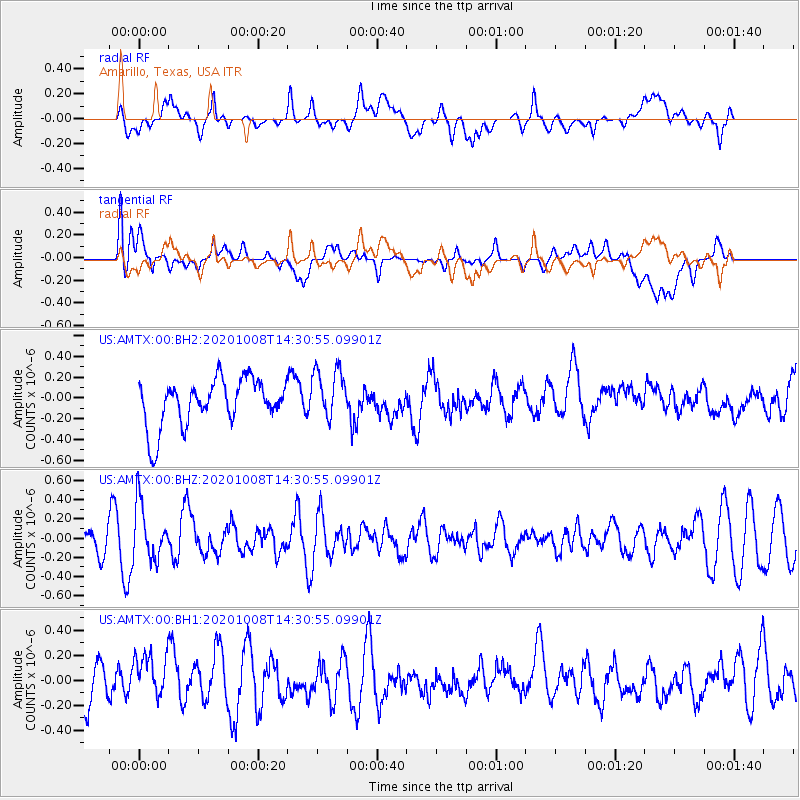
AMTX Amarillo, Texas, USA - Earthquake Result Viewer
*The percent match for this event was below the threshold and hence no stack was calculated.
| Earthquake location: |
Fox Islands, Aleutian Islands |
| Earthquake latitude/longitude: |
52.7/-168.3 |
| Earthquake time(UTC): |
2020/10/08 (282) 14:22:39 GMT |
| Earthquake Depth: |
37 km |
| Earthquake Magnitude: |
5.7 Mww |
| Earthquake Catalog/Contributor: |
NEIC PDE/us |
|
| Network: |
US United States National Seismic Network |
| Station: |
AMTX Amarillo, Texas, USA |
| Lat/Lon: |
34.53 N/101.41 W |
| Elevation: |
1010 m |
|
| Distance: |
49.8 deg |
| Az: |
83.566 deg |
| Baz: |
312.932 deg |
| Ray Param: |
$rayparam |
*The percent match for this event was below the threshold and hence was not used in the summary stack. |
|
| Radial Match: |
47.210163 % |
| Radial Bump: |
400 |
| Transverse Match: |
54.01151 % |
| Transverse Bump: |
400 |
| SOD ConfigId: |
22732711 |
| Insert Time: |
2020-10-22 14:39:02.565 +0000 |
| GWidth: |
2.5 |
| Max Bumps: |
400 |
| Tol: |
0.001 |
|
Signal To Noise
| Channel | StoN | STA | LTA |
| US:AMTX:00:BHZ:20201008T14:30:55.09901Z | 1.7014083 | 2.8684335E-7 | 1.6859173E-7 |
| US:AMTX:00:BH1:20201008T14:30:55.09901Z | 1.2772084 | 1.8693652E-7 | 1.4636336E-7 |
| US:AMTX:00:BH2:20201008T14:30:55.09901Z | 1.2385638 | 2.2277467E-7 | 1.7986532E-7 |
| Arrivals |
| Ps | |
| PpPs | |
| PsPs/PpSs | |


