You are here: Home > Network List > CN - Canadian National Seismograph Network Stations List
> Station INK INUVIK, NT > Earthquake Result Viewer
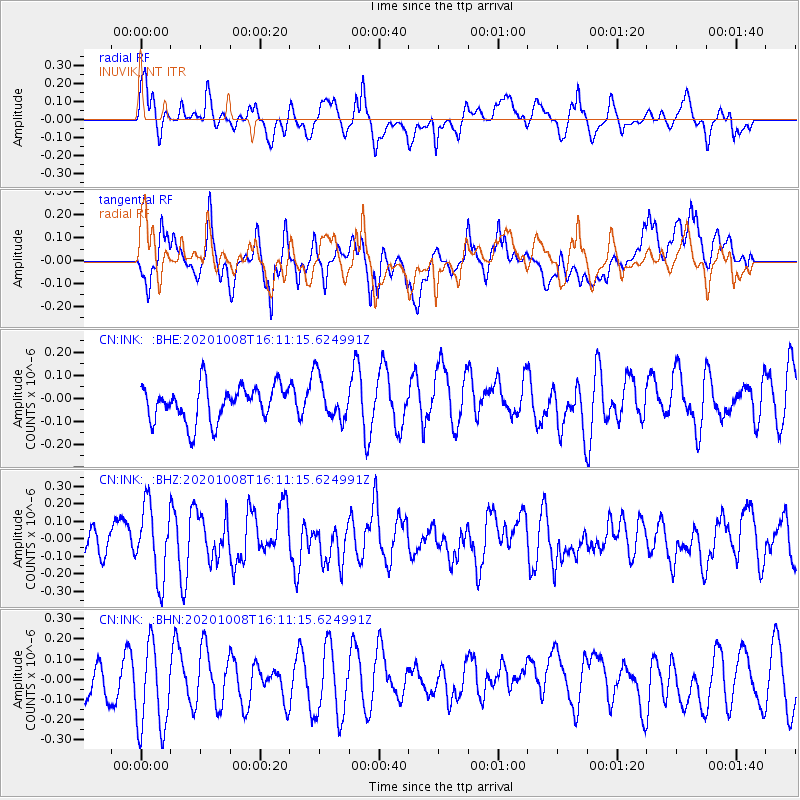
INK INUVIK, NT - Earthquake Result Viewer
*The percent match for this event was below the threshold and hence no stack was calculated.
| Earthquake location: |
New Britain Region, P.N.G. |
| Earthquake latitude/longitude: |
-5.9/150.9 |
| Earthquake time(UTC): |
2020/10/08 (282) 15:58:52 GMT |
| Earthquake Depth: |
59 km |
| Earthquake Magnitude: |
5.5 Mww |
| Earthquake Catalog/Contributor: |
NEIC PDE/us |
|
| Network: |
CN Canadian National Seismograph Network |
| Station: |
INK INUVIK, NT |
| Lat/Lon: |
68.31 N/133.53 W |
| Elevation: |
44 m |
|
| Distance: |
90.2 deg |
| Az: |
21.106 deg |
| Baz: |
254.465 deg |
| Ray Param: |
$rayparam |
*The percent match for this event was below the threshold and hence was not used in the summary stack. |
|
| Radial Match: |
67.914024 % |
| Radial Bump: |
400 |
| Transverse Match: |
51.162445 % |
| Transverse Bump: |
400 |
| SOD ConfigId: |
22732711 |
| Insert Time: |
2020-10-22 16:04:49.242 +0000 |
| GWidth: |
2.5 |
| Max Bumps: |
400 |
| Tol: |
0.001 |
|
Signal To Noise
| Channel | StoN | STA | LTA |
| CN:INK: :BHZ:20201008T16:11:15.624991Z | 1.9143482 | 2.0585396E-7 | 1.07532145E-7 |
| CN:INK: :BHN:20201008T16:11:15.624991Z | 2.5774217 | 2.2932623E-7 | 8.897506E-8 |
| CN:INK: :BHE:20201008T16:11:15.624991Z | 1.1746603 | 9.1226106E-8 | 7.766169E-8 |
| Arrivals |
| Ps | |
| PpPs | |
| PsPs/PpSs | |


