You are here: Home > Network List > US - United States National Seismic Network Stations List
> Station MNTX Cornudas Mountains, Texas, USA > Earthquake Result Viewer
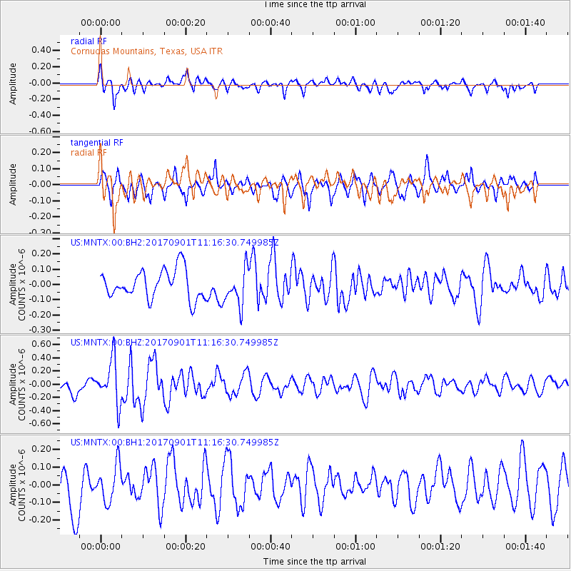
MNTX Cornudas Mountains, Texas, USA - Earthquake Result Viewer
*The percent match for this event was below the threshold and hence no stack was calculated.
| Earthquake location: |
Reykjanes Ridge |
| Earthquake latitude/longitude: |
57.0/-34.0 |
| Earthquake time(UTC): |
2017/09/01 (244) 11:07:37 GMT |
| Earthquake Depth: |
10 km |
| Earthquake Magnitude: |
5.7 Mww |
| Earthquake Catalog/Contributor: |
NEIC PDE/us |
|
| Network: |
US United States National Seismic Network |
| Station: |
MNTX Cornudas Mountains, Texas, USA |
| Lat/Lon: |
31.70 N/105.38 W |
| Elevation: |
404 m |
|
| Distance: |
54.1 deg |
| Az: |
274.076 deg |
| Baz: |
39.756 deg |
| Ray Param: |
$rayparam |
*The percent match for this event was below the threshold and hence was not used in the summary stack. |
|
| Radial Match: |
58.673706 % |
| Radial Bump: |
400 |
| Transverse Match: |
47.941086 % |
| Transverse Bump: |
384 |
| SOD ConfigId: |
2307692 |
| Insert Time: |
2017-09-15 11:13:29.949 +0000 |
| GWidth: |
2.5 |
| Max Bumps: |
400 |
| Tol: |
0.001 |
|
Signal To Noise
| Channel | StoN | STA | LTA |
| US:MNTX:00:BHZ:20170901T11:16:30.749985Z | 4.1216226 | 3.4201472E-7 | 8.2980605E-8 |
| US:MNTX:00:BH1:20170901T11:16:30.749985Z | 0.656139 | 1.08794325E-7 | 1.6580987E-7 |
| US:MNTX:00:BH2:20170901T11:16:30.749985Z | 1.2869674 | 1.2176942E-7 | 9.461733E-8 |
| Arrivals |
| Ps | |
| PpPs | |
| PsPs/PpSs | |


