You are here: Home > Network List > US - United States National Seismic Network Stations List
> Station MSO Missoula, Montana, USA > Earthquake Result Viewer
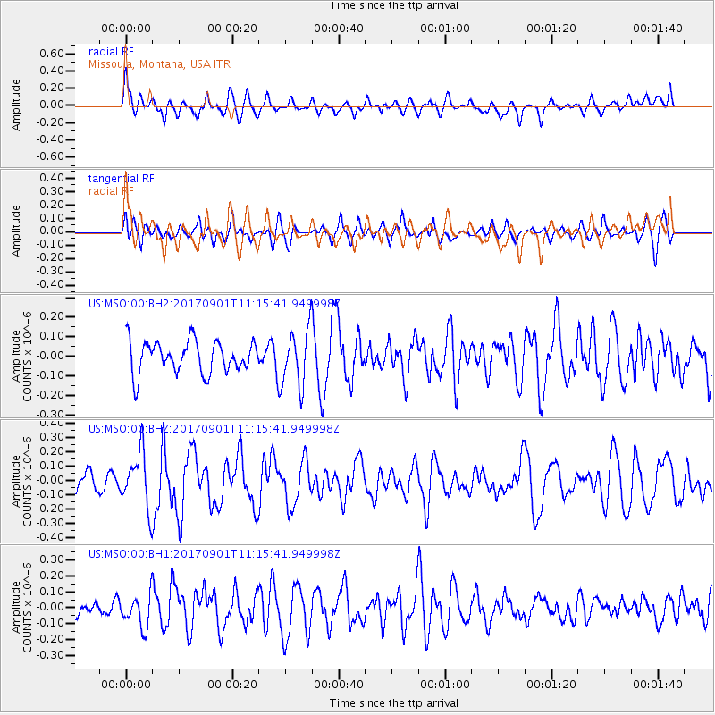
MSO Missoula, Montana, USA - Earthquake Result Viewer
*The percent match for this event was below the threshold and hence no stack was calculated.
| Earthquake location: |
Reykjanes Ridge |
| Earthquake latitude/longitude: |
57.0/-34.0 |
| Earthquake time(UTC): |
2017/09/01 (244) 11:07:37 GMT |
| Earthquake Depth: |
10 km |
| Earthquake Magnitude: |
5.7 Mww |
| Earthquake Catalog/Contributor: |
NEIC PDE/us |
|
| Network: |
US United States National Seismic Network |
| Station: |
MSO Missoula, Montana, USA |
| Lat/Lon: |
46.83 N/113.94 W |
| Elevation: |
1264 m |
|
| Distance: |
47.6 deg |
| Az: |
293.691 deg |
| Baz: |
46.791 deg |
| Ray Param: |
$rayparam |
*The percent match for this event was below the threshold and hence was not used in the summary stack. |
|
| Radial Match: |
60.44769 % |
| Radial Bump: |
400 |
| Transverse Match: |
57.639286 % |
| Transverse Bump: |
400 |
| SOD ConfigId: |
2307692 |
| Insert Time: |
2017-09-15 11:13:32.519 +0000 |
| GWidth: |
2.5 |
| Max Bumps: |
400 |
| Tol: |
0.001 |
|
Signal To Noise
| Channel | StoN | STA | LTA |
| US:MSO:00:BHZ:20170901T11:15:41.949998Z | 2.1589649 | 1.9410098E-7 | 8.9904646E-8 |
| US:MSO:00:BH1:20170901T11:15:41.949998Z | 0.9857989 | 1.0355653E-7 | 1.05048336E-7 |
| US:MSO:00:BH2:20170901T11:15:41.949998Z | 1.7966357 | 1.4540855E-7 | 8.093379E-8 |
| Arrivals |
| Ps | |
| PpPs | |
| PsPs/PpSs | |


