You are here: Home > Network List > US - United States National Seismic Network Stations List
> Station EGMT Eagleton, Montana, USA > Earthquake Result Viewer
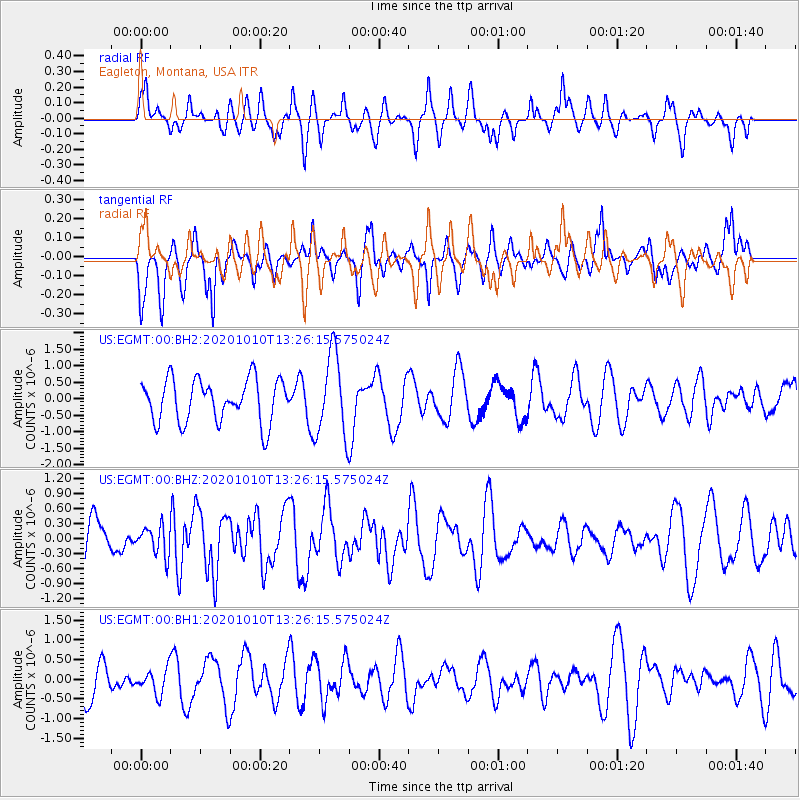
EGMT Eagleton, Montana, USA - Earthquake Result Viewer
*The percent match for this event was below the threshold and hence no stack was calculated.
| Earthquake location: |
Easter Island Region |
| Earthquake latitude/longitude: |
-28.6/-112.3 |
| Earthquake time(UTC): |
2020/10/10 (284) 13:14:57 GMT |
| Earthquake Depth: |
10 km |
| Earthquake Magnitude: |
6.0 mww |
| Earthquake Catalog/Contributor: |
NEIC PDE/us |
|
| Network: |
US United States National Seismic Network |
| Station: |
EGMT Eagleton, Montana, USA |
| Lat/Lon: |
48.02 N/109.75 W |
| Elevation: |
1055 m |
|
| Distance: |
76.4 deg |
| Az: |
1.74 deg |
| Baz: |
182.279 deg |
| Ray Param: |
$rayparam |
*The percent match for this event was below the threshold and hence was not used in the summary stack. |
|
| Radial Match: |
58.974846 % |
| Radial Bump: |
390 |
| Transverse Match: |
30.970137 % |
| Transverse Bump: |
304 |
| SOD ConfigId: |
22732711 |
| Insert Time: |
2020-10-24 13:32:28.420 +0000 |
| GWidth: |
2.5 |
| Max Bumps: |
400 |
| Tol: |
0.001 |
|
Signal To Noise
| Channel | StoN | STA | LTA |
| US:EGMT:00:BHZ:20201010T13:26:15.575024Z | 0.6778292 | 2.854632E-7 | 4.2114323E-7 |
| US:EGMT:00:BH1:20201010T13:26:15.575024Z | 0.65767777 | 3.2190738E-7 | 4.8946066E-7 |
| US:EGMT:00:BH2:20201010T13:26:15.575024Z | 1.9331195 | 1.253575E-6 | 6.4847256E-7 |
| Arrivals |
| Ps | |
| PpPs | |
| PsPs/PpSs | |


