You are here: Home > Network List > UU - University of Utah Regional Network Stations List
> Station FORU South Mineral Mountains, UT, USA > Earthquake Result Viewer
FORU South Mineral Mountains, UT, USA - Earthquake Result Viewer
*The percent match for this event was below the threshold and hence no stack was calculated.
| Earthquake location: |
Easter Island Region |
| Earthquake latitude/longitude: |
-28.6/-112.3 |
| Earthquake time(UTC): |
2020/10/10 (284) 13:14:57 GMT |
| Earthquake Depth: |
10 km |
| Earthquake Magnitude: |
6.0 mww |
| Earthquake Catalog/Contributor: |
NEIC PDE/us |
|
| Network: |
UU University of Utah Regional Network |
| Station: |
FORU South Mineral Mountains, UT, USA |
| Lat/Lon: |
38.46 N/112.86 W |
| Elevation: |
1840 m |
|
| Distance: |
66.8 deg |
| Az: |
359.498 deg |
| Baz: |
179.438 deg |
| Ray Param: |
$rayparam |
*The percent match for this event was below the threshold and hence was not used in the summary stack. |
|
| Radial Match: |
76.33166 % |
| Radial Bump: |
400 |
| Transverse Match: |
42.7985 % |
| Transverse Bump: |
400 |
| SOD ConfigId: |
22732711 |
| Insert Time: |
2020-10-24 13:32:58.110 +0000 |
| GWidth: |
2.5 |
| Max Bumps: |
400 |
| Tol: |
0.001 |
|
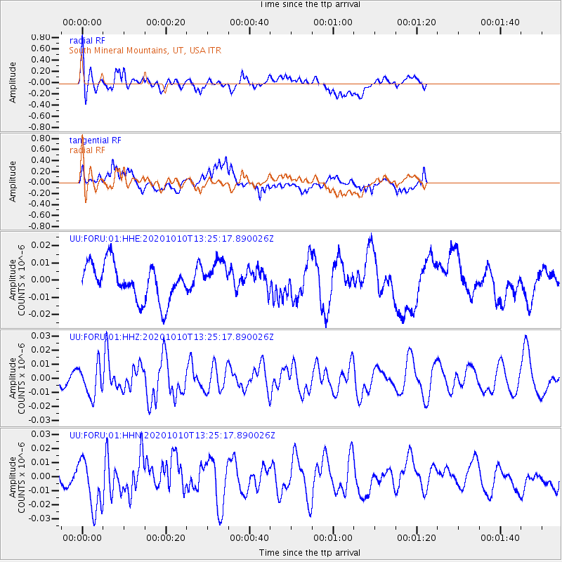
Signal To Noise
| Channel | StoN | STA | LTA |
| UU:FORU:01:HHZ:20201010T13:25:17.890026Z | 1.6203874 | 1.10996226E-8 | 6.8499806E-9 |
| UU:FORU:01:HHN:20201010T13:25:17.890026Z | 2.6778333 | 1.888538E-8 | 7.0524857E-9 |
| UU:FORU:01:HHE:20201010T13:25:17.890026Z | 0.93488806 | 9.744718E-9 | 1.0423407E-8 |
| Arrivals |
| Ps | |
| PpPs | |
| PsPs/PpSs | |


