You are here: Home > Network List > CI - Caltech Regional Seismic Network Stations List
> Station MPM Manuel Prospect Mine, California, USA > Earthquake Result Viewer
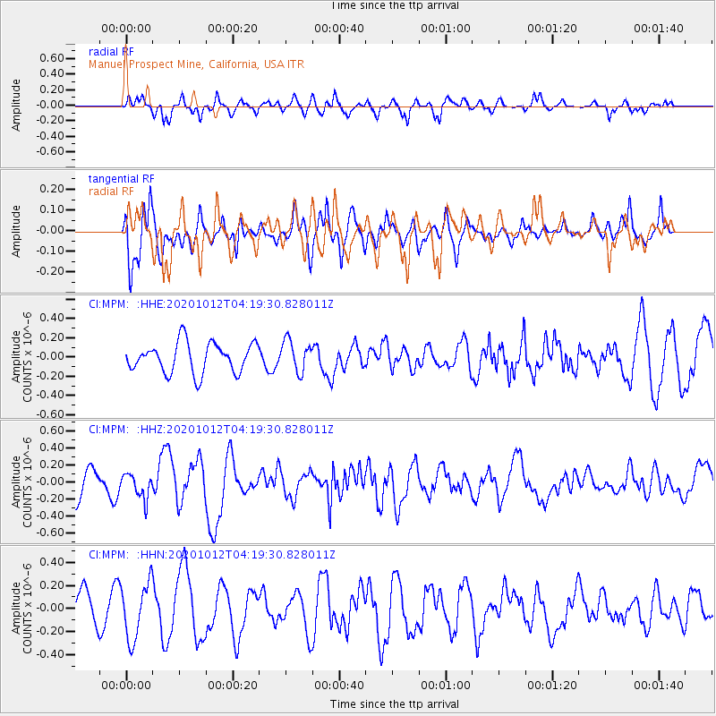
MPM Manuel Prospect Mine, California, USA - Earthquake Result Viewer
*The percent match for this event was below the threshold and hence no stack was calculated.
| Earthquake location: |
Near Coast Of Chiapas, Mexico |
| Earthquake latitude/longitude: |
14.9/-93.6 |
| Earthquake time(UTC): |
2020/10/12 (286) 04:13:53 GMT |
| Earthquake Depth: |
18 km |
| Earthquake Magnitude: |
5.5 Mww |
| Earthquake Catalog/Contributor: |
NEIC PDE/us |
|
| Network: |
CI Caltech Regional Seismic Network |
| Station: |
MPM Manuel Prospect Mine, California, USA |
| Lat/Lon: |
36.06 N/117.49 W |
| Elevation: |
185 m |
|
| Distance: |
30.0 deg |
| Az: |
319.02 deg |
| Baz: |
128.499 deg |
| Ray Param: |
$rayparam |
*The percent match for this event was below the threshold and hence was not used in the summary stack. |
|
| Radial Match: |
68.39145 % |
| Radial Bump: |
380 |
| Transverse Match: |
61.63904 % |
| Transverse Bump: |
400 |
| SOD ConfigId: |
22732711 |
| Insert Time: |
2020-10-26 04:34:43.158 +0000 |
| GWidth: |
2.5 |
| Max Bumps: |
400 |
| Tol: |
0.001 |
|
Signal To Noise
| Channel | StoN | STA | LTA |
| CI:MPM: :HHZ:20201012T04:19:30.828011Z | 1.0149618 | 1.462555E-7 | 1.440995E-7 |
| CI:MPM: :HHN:20201012T04:19:30.828011Z | 1.7221806 | 2.4479556E-7 | 1.421428E-7 |
| CI:MPM: :HHE:20201012T04:19:30.828011Z | 1.0501537 | 1.6258656E-7 | 1.5482168E-7 |
| Arrivals |
| Ps | |
| PpPs | |
| PsPs/PpSs | |


