You are here: Home > Network List > CN - Canadian National Seismograph Network Stations List
> Station INK INUVIK, NT > Earthquake Result Viewer
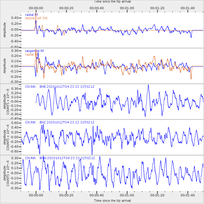
INK INUVIK, NT - Earthquake Result Viewer
*The percent match for this event was below the threshold and hence no stack was calculated.
| Earthquake location: |
Near Coast Of Chiapas, Mexico |
| Earthquake latitude/longitude: |
14.9/-93.6 |
| Earthquake time(UTC): |
2020/10/12 (286) 04:13:53 GMT |
| Earthquake Depth: |
18 km |
| Earthquake Magnitude: |
5.5 Mww |
| Earthquake Catalog/Contributor: |
NEIC PDE/us |
|
| Network: |
CN Canadian National Seismograph Network |
| Station: |
INK INUVIK, NT |
| Lat/Lon: |
68.31 N/133.53 W |
| Elevation: |
44 m |
|
| Distance: |
59.2 deg |
| Az: |
343.866 deg |
| Baz: |
133.715 deg |
| Ray Param: |
$rayparam |
*The percent match for this event was below the threshold and hence was not used in the summary stack. |
|
| Radial Match: |
54.188 % |
| Radial Bump: |
400 |
| Transverse Match: |
57.1519 % |
| Transverse Bump: |
400 |
| SOD ConfigId: |
22732711 |
| Insert Time: |
2020-10-26 04:35:20.731 +0000 |
| GWidth: |
2.5 |
| Max Bumps: |
400 |
| Tol: |
0.001 |
|
Signal To Noise
| Channel | StoN | STA | LTA |
| CN:INK: :BHZ:20201012T04:23:22.325021Z | 2.6209908 | 3.2742014E-7 | 1.2492228E-7 |
| CN:INK: :BHN:20201012T04:23:22.325021Z | 1.1860111 | 1.5180255E-7 | 1.2799421E-7 |
| CN:INK: :BHE:20201012T04:23:22.325021Z | 0.8965165 | 1.2575332E-7 | 1.4026884E-7 |
| Arrivals |
| Ps | |
| PpPs | |
| PsPs/PpSs | |


