You are here: Home > Network List > TA - USArray Transportable Network (new EarthScope stations) Stations List
> Station L15K Ungalak Mountain, AK, USA > Earthquake Result Viewer
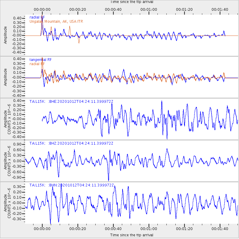
L15K Ungalak Mountain, AK, USA - Earthquake Result Viewer
*The percent match for this event was below the threshold and hence no stack was calculated.
| Earthquake location: |
Near Coast Of Chiapas, Mexico |
| Earthquake latitude/longitude: |
14.9/-93.6 |
| Earthquake time(UTC): |
2020/10/12 (286) 04:13:53 GMT |
| Earthquake Depth: |
18 km |
| Earthquake Magnitude: |
5.5 Mww |
| Earthquake Catalog/Contributor: |
NEIC PDE/us |
|
| Network: |
TA USArray Transportable Network (new EarthScope stations) |
| Station: |
L15K Ungalak Mountain, AK, USA |
| Lat/Lon: |
61.68 N/161.49 W |
| Elevation: |
219 m |
|
| Distance: |
66.6 deg |
| Az: |
331.215 deg |
| Baz: |
102.478 deg |
| Ray Param: |
$rayparam |
*The percent match for this event was below the threshold and hence was not used in the summary stack. |
|
| Radial Match: |
70.29748 % |
| Radial Bump: |
400 |
| Transverse Match: |
58.47983 % |
| Transverse Bump: |
400 |
| SOD ConfigId: |
22732711 |
| Insert Time: |
2020-10-26 04:40:30.979 +0000 |
| GWidth: |
2.5 |
| Max Bumps: |
400 |
| Tol: |
0.001 |
|
Signal To Noise
| Channel | StoN | STA | LTA |
| TA:L15K: :BHZ:20201012T04:24:11.399972Z | 2.1596029 | 2.549707E-7 | 1.18063696E-7 |
| TA:L15K: :BHN:20201012T04:24:11.399972Z | 1.7650744 | 1.3077815E-7 | 7.409214E-8 |
| TA:L15K: :BHE:20201012T04:24:11.399972Z | 2.226979 | 1.5612721E-7 | 7.0107184E-8 |
| Arrivals |
| Ps | |
| PpPs | |
| PsPs/PpSs | |


