You are here: Home > Network List > US - United States National Seismic Network Stations List
> Station DGMT Dagmar, Montana, USA > Earthquake Result Viewer
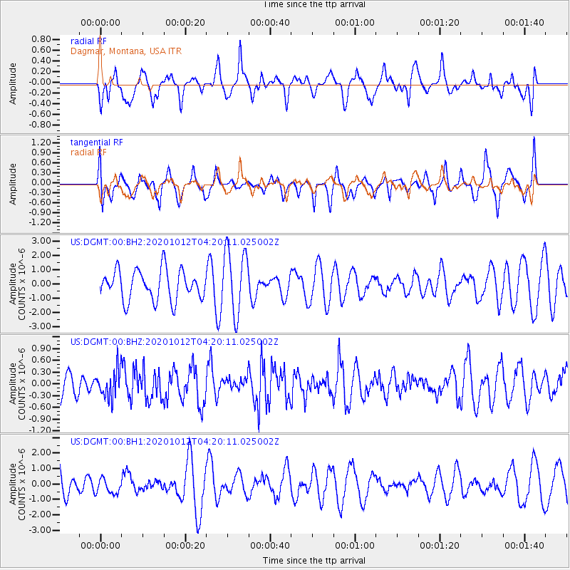
DGMT Dagmar, Montana, USA - Earthquake Result Viewer
*The percent match for this event was below the threshold and hence no stack was calculated.
| Earthquake location: |
Near Coast Of Chiapas, Mexico |
| Earthquake latitude/longitude: |
14.9/-93.6 |
| Earthquake time(UTC): |
2020/10/12 (286) 04:13:53 GMT |
| Earthquake Depth: |
18 km |
| Earthquake Magnitude: |
5.5 Mww |
| Earthquake Catalog/Contributor: |
NEIC PDE/us |
|
| Network: |
US United States National Seismic Network |
| Station: |
DGMT Dagmar, Montana, USA |
| Lat/Lon: |
48.47 N/104.20 W |
| Elevation: |
0.0 m |
|
| Distance: |
34.6 deg |
| Az: |
347.554 deg |
| Baz: |
161.75 deg |
| Ray Param: |
$rayparam |
*The percent match for this event was below the threshold and hence was not used in the summary stack. |
|
| Radial Match: |
46.50881 % |
| Radial Bump: |
400 |
| Transverse Match: |
58.658504 % |
| Transverse Bump: |
393 |
| SOD ConfigId: |
22732711 |
| Insert Time: |
2020-10-26 04:41:26.698 +0000 |
| GWidth: |
2.5 |
| Max Bumps: |
400 |
| Tol: |
0.001 |
|
Signal To Noise
| Channel | StoN | STA | LTA |
| US:DGMT:00:BHZ:20201012T04:20:11.025002Z | 0.96812814 | 3.6652358E-7 | 3.7858996E-7 |
| US:DGMT:00:BH1:20201012T04:20:11.025002Z | 0.57828796 | 4.6920925E-7 | 8.113765E-7 |
| US:DGMT:00:BH2:20201012T04:20:11.025002Z | 2.1852534 | 2.2993624E-6 | 1.0522177E-6 |
| Arrivals |
| Ps | |
| PpPs | |
| PsPs/PpSs | |


