You are here: Home > Network List > US - United States National Seismic Network Stations List
> Station EGMT Eagleton, Montana, USA > Earthquake Result Viewer
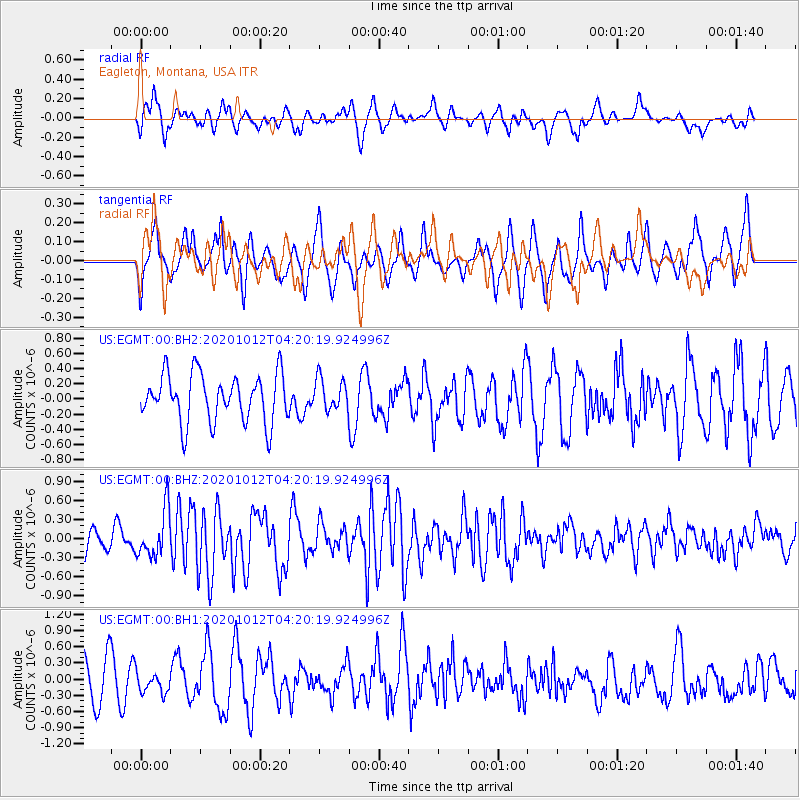
EGMT Eagleton, Montana, USA - Earthquake Result Viewer
*The percent match for this event was below the threshold and hence no stack was calculated.
| Earthquake location: |
Near Coast Of Chiapas, Mexico |
| Earthquake latitude/longitude: |
14.9/-93.6 |
| Earthquake time(UTC): |
2020/10/12 (286) 04:13:53 GMT |
| Earthquake Depth: |
18 km |
| Earthquake Magnitude: |
5.5 Mww |
| Earthquake Catalog/Contributor: |
NEIC PDE/us |
|
| Network: |
US United States National Seismic Network |
| Station: |
EGMT Eagleton, Montana, USA |
| Lat/Lon: |
48.02 N/109.75 W |
| Elevation: |
1055 m |
|
| Distance: |
35.7 deg |
| Az: |
341.307 deg |
| Baz: |
152.504 deg |
| Ray Param: |
$rayparam |
*The percent match for this event was below the threshold and hence was not used in the summary stack. |
|
| Radial Match: |
51.943882 % |
| Radial Bump: |
384 |
| Transverse Match: |
50.944096 % |
| Transverse Bump: |
367 |
| SOD ConfigId: |
22732711 |
| Insert Time: |
2020-10-26 04:41:27.739 +0000 |
| GWidth: |
2.5 |
| Max Bumps: |
400 |
| Tol: |
0.001 |
|
Signal To Noise
| Channel | StoN | STA | LTA |
| US:EGMT:00:BHZ:20201012T04:20:19.924996Z | 1.8761235 | 3.6948182E-7 | 1.9693897E-7 |
| US:EGMT:00:BH1:20201012T04:20:19.924996Z | 0.51993245 | 1.8371287E-7 | 3.5333989E-7 |
| US:EGMT:00:BH2:20201012T04:20:19.924996Z | 0.6600519 | 2.0850308E-7 | 3.1588894E-7 |
| Arrivals |
| Ps | |
| PpPs | |
| PsPs/PpSs | |


