You are here: Home > Network List > US - United States National Seismic Network Stations List
> Station ELK Elko, Nevada, USA > Earthquake Result Viewer
ELK Elko, Nevada, USA - Earthquake Result Viewer
*The percent match for this event was below the threshold and hence no stack was calculated.
| Earthquake location: |
Near Coast Of Chiapas, Mexico |
| Earthquake latitude/longitude: |
14.9/-93.6 |
| Earthquake time(UTC): |
2020/10/12 (286) 04:13:53 GMT |
| Earthquake Depth: |
18 km |
| Earthquake Magnitude: |
5.5 Mww |
| Earthquake Catalog/Contributor: |
NEIC PDE/us |
|
| Network: |
US United States National Seismic Network |
| Station: |
ELK Elko, Nevada, USA |
| Lat/Lon: |
40.74 N/115.24 W |
| Elevation: |
2210 m |
|
| Distance: |
32.0 deg |
| Az: |
328.01 deg |
| Baz: |
137.603 deg |
| Ray Param: |
$rayparam |
*The percent match for this event was below the threshold and hence was not used in the summary stack. |
|
| Radial Match: |
66.14123 % |
| Radial Bump: |
400 |
| Transverse Match: |
52.601814 % |
| Transverse Bump: |
400 |
| SOD ConfigId: |
22732711 |
| Insert Time: |
2020-10-26 04:41:29.354 +0000 |
| GWidth: |
2.5 |
| Max Bumps: |
400 |
| Tol: |
0.001 |
|
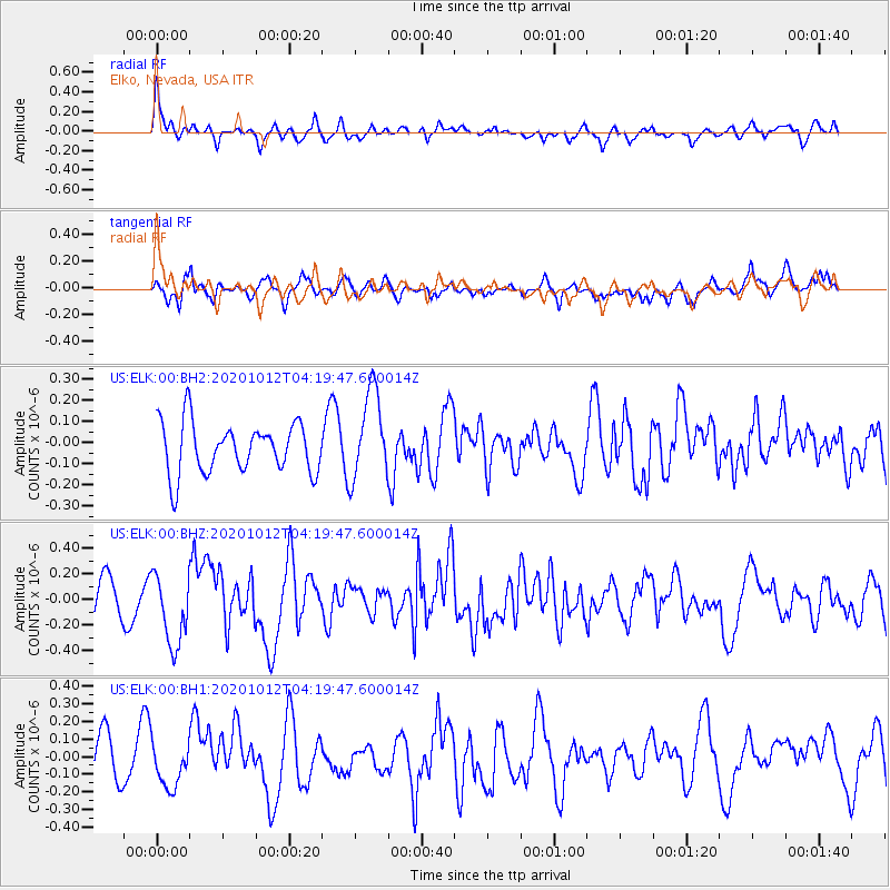
Signal To Noise
| Channel | StoN | STA | LTA |
| US:ELK:00:BHZ:20201012T04:19:47.600014Z | 2.4894598 | 2.8188603E-7 | 1.1323181E-7 |
| US:ELK:00:BH1:20201012T04:19:47.600014Z | 1.187537 | 1.2189624E-7 | 1.0264627E-7 |
| US:ELK:00:BH2:20201012T04:19:47.600014Z | 1.76663 | 2.1031971E-7 | 1.19051364E-7 |
| Arrivals |
| Ps | |
| PpPs | |
| PsPs/PpSs | |


