You are here: Home > Network List > AV - Alaska Volcano Observatory Stations List
> Station MNAT Nateekin Bay, Makushin Volcano, Alaska > Earthquake Result Viewer
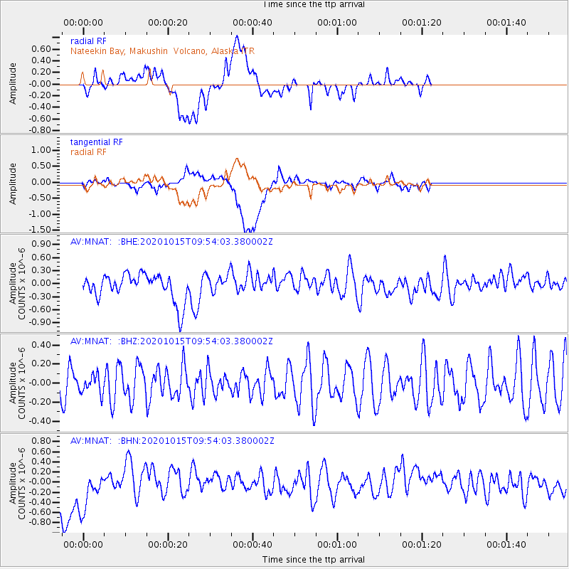
MNAT Nateekin Bay, Makushin Volcano, Alaska - Earthquake Result Viewer
*The percent match for this event was below the threshold and hence no stack was calculated.
| Earthquake location: |
Southern Sumatra, Indonesia |
| Earthquake latitude/longitude: |
-3.2/100.3 |
| Earthquake time(UTC): |
2020/10/15 (289) 09:41:15 GMT |
| Earthquake Depth: |
10 km |
| Earthquake Magnitude: |
5.2 Mww |
| Earthquake Catalog/Contributor: |
NEIC PDE/us |
|
| Network: |
AV Alaska Volcano Observatory |
| Station: |
MNAT Nateekin Bay, Makushin Volcano, Alaska |
| Lat/Lon: |
53.88 N/166.69 W |
| Elevation: |
390 m |
|
| Distance: |
94.4 deg |
| Az: |
36.365 deg |
| Baz: |
270.507 deg |
| Ray Param: |
$rayparam |
*The percent match for this event was below the threshold and hence was not used in the summary stack. |
|
| Radial Match: |
49.883102 % |
| Radial Bump: |
400 |
| Transverse Match: |
48.896484 % |
| Transverse Bump: |
400 |
| SOD ConfigId: |
22732711 |
| Insert Time: |
2020-10-29 09:43:53.264 +0000 |
| GWidth: |
2.5 |
| Max Bumps: |
400 |
| Tol: |
0.001 |
|
Signal To Noise
| Channel | StoN | STA | LTA |
| AV:MNAT: :BHZ:20201015T09:54:03.380002Z | 0.5329881 | 9.732067E-8 | 1.8259448E-7 |
| AV:MNAT: :BHN:20201015T09:54:03.380002Z | 1.5869488 | 4.9555376E-7 | 3.122683E-7 |
| AV:MNAT: :BHE:20201015T09:54:03.380002Z | 0.7169135 | 2.1692324E-7 | 3.0257937E-7 |
| Arrivals |
| Ps | |
| PpPs | |
| PsPs/PpSs | |


