You are here: Home > Network List > AV - Alaska Volcano Observatory Stations List
> Station SPCR Ckakachatna River, Mount Spurr, Alaska > Earthquake Result Viewer
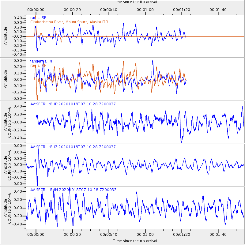
SPCR Ckakachatna River, Mount Spurr, Alaska - Earthquake Result Viewer
*The percent match for this event was below the threshold and hence no stack was calculated.
| Earthquake location: |
Near Coast Of Northern Peru |
| Earthquake latitude/longitude: |
-3.9/-81.8 |
| Earthquake time(UTC): |
2020/10/18 (292) 06:58:29 GMT |
| Earthquake Depth: |
10 km |
| Earthquake Magnitude: |
5.5 Mww |
| Earthquake Catalog/Contributor: |
NEIC PDE/us |
|
| Network: |
AV Alaska Volcano Observatory |
| Station: |
SPCR Ckakachatna River, Mount Spurr, Alaska |
| Lat/Lon: |
61.20 N/152.21 W |
| Elevation: |
984 m |
|
| Distance: |
84.1 deg |
| Az: |
332.708 deg |
| Baz: |
109.135 deg |
| Ray Param: |
$rayparam |
*The percent match for this event was below the threshold and hence was not used in the summary stack. |
|
| Radial Match: |
48.57879 % |
| Radial Bump: |
400 |
| Transverse Match: |
56.652424 % |
| Transverse Bump: |
400 |
| SOD ConfigId: |
22732711 |
| Insert Time: |
2020-11-01 07:05:04.798 +0000 |
| GWidth: |
2.5 |
| Max Bumps: |
400 |
| Tol: |
0.001 |
|
Signal To Noise
| Channel | StoN | STA | LTA |
| AV:SPCR: :BHZ:20201018T07:10:28.720003Z | 2.1554048 | 3.3363526E-7 | 1.5479007E-7 |
| AV:SPCR: :BHN:20201018T07:10:28.720003Z | 1.5576102 | 2.1096598E-7 | 1.354421E-7 |
| AV:SPCR: :BHE:20201018T07:10:28.720003Z | 1.3842353 | 1.6760718E-7 | 1.2108288E-7 |
| Arrivals |
| Ps | |
| PpPs | |
| PsPs/PpSs | |


