You are here: Home > Network List > CI - Caltech Regional Seismic Network Stations List
> Station MPM Manuel Prospect Mine, California, USA > Earthquake Result Viewer
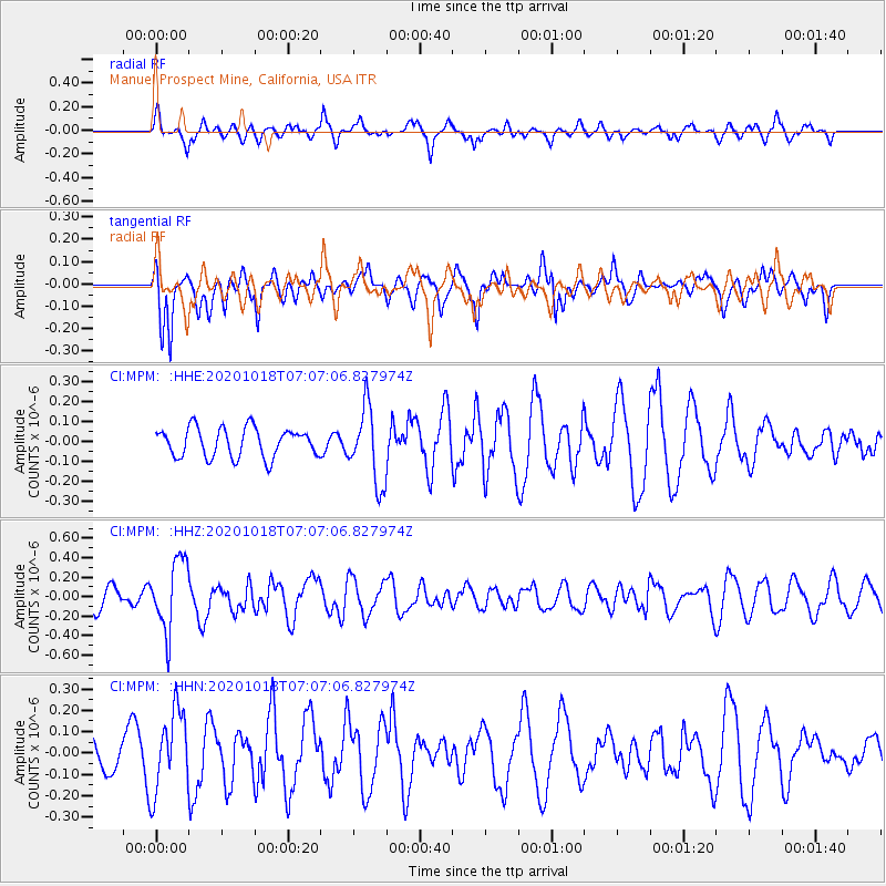
MPM Manuel Prospect Mine, California, USA - Earthquake Result Viewer
*The percent match for this event was below the threshold and hence no stack was calculated.
| Earthquake location: |
Near Coast Of Northern Peru |
| Earthquake latitude/longitude: |
-3.9/-81.8 |
| Earthquake time(UTC): |
2020/10/18 (292) 06:58:29 GMT |
| Earthquake Depth: |
10 km |
| Earthquake Magnitude: |
5.5 Mww |
| Earthquake Catalog/Contributor: |
NEIC PDE/us |
|
| Network: |
CI Caltech Regional Seismic Network |
| Station: |
MPM Manuel Prospect Mine, California, USA |
| Lat/Lon: |
36.06 N/117.49 W |
| Elevation: |
185 m |
|
| Distance: |
51.9 deg |
| Az: |
323.11 deg |
| Baz: |
132.343 deg |
| Ray Param: |
$rayparam |
*The percent match for this event was below the threshold and hence was not used in the summary stack. |
|
| Radial Match: |
63.513657 % |
| Radial Bump: |
386 |
| Transverse Match: |
60.944916 % |
| Transverse Bump: |
389 |
| SOD ConfigId: |
22732711 |
| Insert Time: |
2020-11-01 07:08:55.435 +0000 |
| GWidth: |
2.5 |
| Max Bumps: |
400 |
| Tol: |
0.001 |
|
Signal To Noise
| Channel | StoN | STA | LTA |
| CI:MPM: :HHZ:20201018T07:07:06.827974Z | 2.348093 | 3.5874655E-7 | 1.5278208E-7 |
| CI:MPM: :HHN:20201018T07:07:06.827974Z | 2.2614818 | 1.8738965E-7 | 8.286145E-8 |
| CI:MPM: :HHE:20201018T07:07:06.827974Z | 2.599151 | 1.8864891E-7 | 7.2580974E-8 |
| Arrivals |
| Ps | |
| PpPs | |
| PsPs/PpSs | |


