You are here: Home > Network List > CI - Caltech Regional Seismic Network Stations List
> Station SMM Simmler, CA, USA > Earthquake Result Viewer
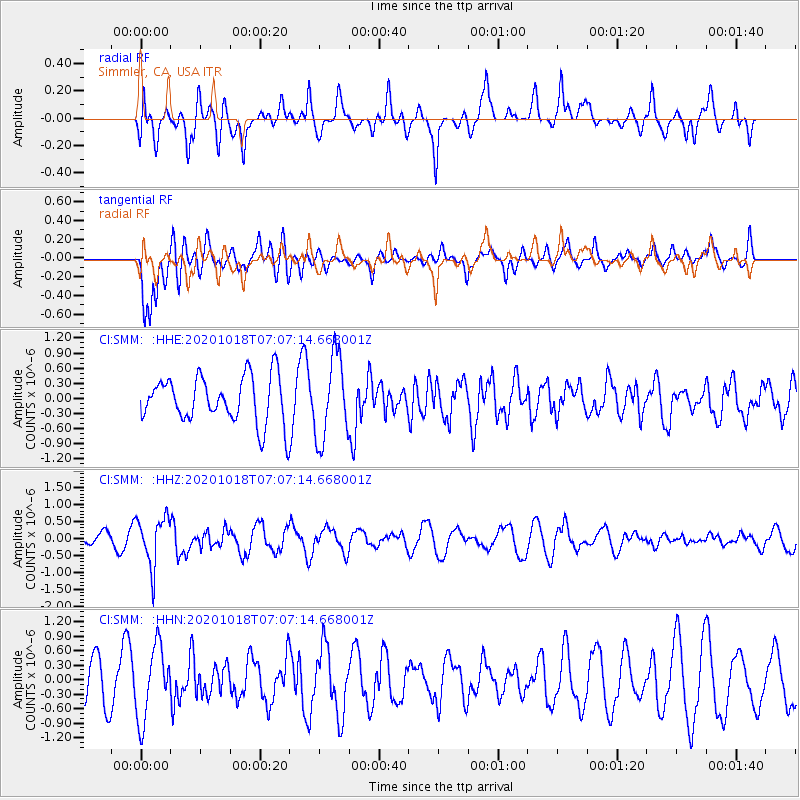
SMM Simmler, CA, USA - Earthquake Result Viewer
*The percent match for this event was below the threshold and hence no stack was calculated.
| Earthquake location: |
Near Coast Of Northern Peru |
| Earthquake latitude/longitude: |
-3.9/-81.8 |
| Earthquake time(UTC): |
2020/10/18 (292) 06:58:29 GMT |
| Earthquake Depth: |
10 km |
| Earthquake Magnitude: |
5.5 Mww |
| Earthquake Catalog/Contributor: |
NEIC PDE/us |
|
| Network: |
CI Caltech Regional Seismic Network |
| Station: |
SMM Simmler, CA, USA |
| Lat/Lon: |
35.31 N/120.00 W |
| Elevation: |
599 m |
|
| Distance: |
52.9 deg |
| Az: |
320.716 deg |
| Baz: |
129.426 deg |
| Ray Param: |
$rayparam |
*The percent match for this event was below the threshold and hence was not used in the summary stack. |
|
| Radial Match: |
54.806496 % |
| Radial Bump: |
400 |
| Transverse Match: |
57.169277 % |
| Transverse Bump: |
400 |
| SOD ConfigId: |
22732711 |
| Insert Time: |
2020-11-01 07:09:21.501 +0000 |
| GWidth: |
2.5 |
| Max Bumps: |
400 |
| Tol: |
0.001 |
|
Signal To Noise
| Channel | StoN | STA | LTA |
| CI:SMM: :HHZ:20201018T07:07:14.668001Z | 4.3335423 | 7.2774867E-7 | 1.679339E-7 |
| CI:SMM: :HHN:20201018T07:07:14.668001Z | 1.533647 | 7.521634E-7 | 4.9044104E-7 |
| CI:SMM: :HHE:20201018T07:07:14.668001Z | 1.7778015 | 8.205561E-7 | 4.6155665E-7 |
| Arrivals |
| Ps | |
| PpPs | |
| PsPs/PpSs | |


