You are here: Home > Network List > CN - Canadian National Seismograph Network Stations List
> Station INK INUVIK, NT > Earthquake Result Viewer
INK INUVIK, NT - Earthquake Result Viewer
*The percent match for this event was below the threshold and hence no stack was calculated.
| Earthquake location: |
Near Coast Of Northern Peru |
| Earthquake latitude/longitude: |
-3.9/-81.8 |
| Earthquake time(UTC): |
2020/10/18 (292) 06:58:29 GMT |
| Earthquake Depth: |
10 km |
| Earthquake Magnitude: |
5.5 Mww |
| Earthquake Catalog/Contributor: |
NEIC PDE/us |
|
| Network: |
CN Canadian National Seismograph Network |
| Station: |
INK INUVIK, NT |
| Lat/Lon: |
68.31 N/133.53 W |
| Elevation: |
44 m |
|
| Distance: |
80.4 deg |
| Az: |
342.791 deg |
| Baz: |
127.442 deg |
| Ray Param: |
$rayparam |
*The percent match for this event was below the threshold and hence was not used in the summary stack. |
|
| Radial Match: |
49.575634 % |
| Radial Bump: |
400 |
| Transverse Match: |
46.75838 % |
| Transverse Bump: |
400 |
| SOD ConfigId: |
22732711 |
| Insert Time: |
2020-11-01 07:10:26.237 +0000 |
| GWidth: |
2.5 |
| Max Bumps: |
400 |
| Tol: |
0.001 |
|
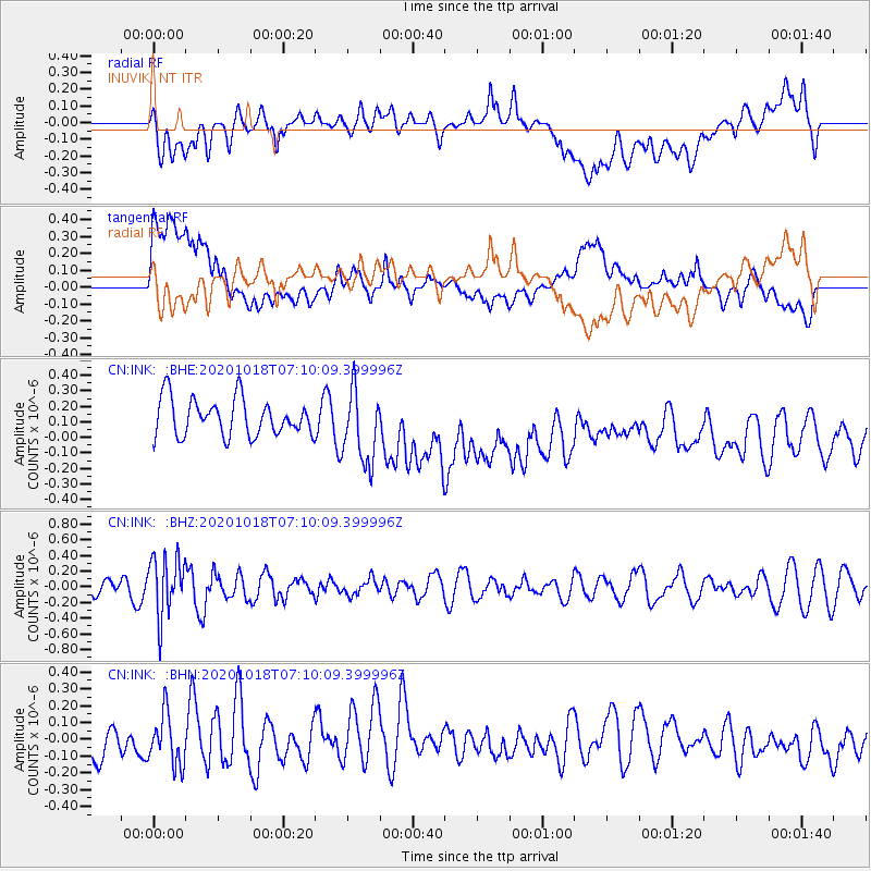
Signal To Noise
| Channel | StoN | STA | LTA |
| CN:INK: :BHZ:20201018T07:10:09.399996Z | 2.4687457 | 3.7995764E-7 | 1.5390717E-7 |
| CN:INK: :BHN:20201018T07:10:09.399996Z | 1.3002683 | 1.507357E-7 | 1.1592662E-7 |
| CN:INK: :BHE:20201018T07:10:09.399996Z | 2.001138 | 2.387018E-7 | 1.1928303E-7 |
| Arrivals |
| Ps | |
| PpPs | |
| PsPs/PpSs | |


