You are here: Home > Network List > TA - USArray Transportable Network (new EarthScope stations) Stations List
> Station H31M Peel River, Yukon, CAN > Earthquake Result Viewer
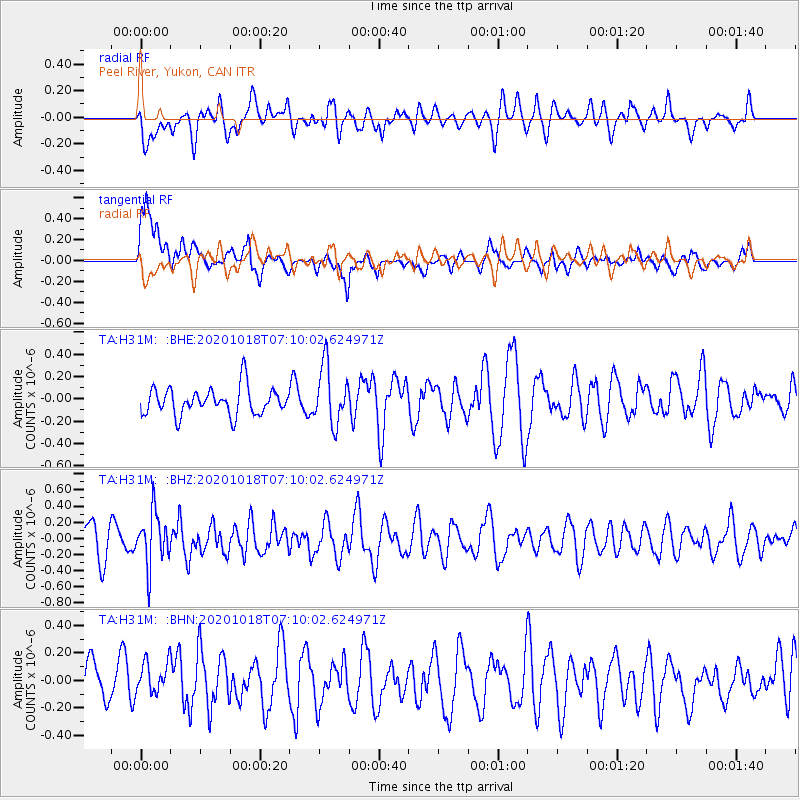
H31M Peel River, Yukon, CAN - Earthquake Result Viewer
*The percent match for this event was below the threshold and hence no stack was calculated.
| Earthquake location: |
Near Coast Of Northern Peru |
| Earthquake latitude/longitude: |
-3.9/-81.8 |
| Earthquake time(UTC): |
2020/10/18 (292) 06:58:29 GMT |
| Earthquake Depth: |
10 km |
| Earthquake Magnitude: |
5.5 Mww |
| Earthquake Catalog/Contributor: |
NEIC PDE/us |
|
| Network: |
TA USArray Transportable Network (new EarthScope stations) |
| Station: |
H31M Peel River, Yukon, CAN |
| Lat/Lon: |
65.81 N/134.34 W |
| Elevation: |
642 m |
|
| Distance: |
79.1 deg |
| Az: |
340.552 deg |
| Baz: |
126.292 deg |
| Ray Param: |
$rayparam |
*The percent match for this event was below the threshold and hence was not used in the summary stack. |
|
| Radial Match: |
54.65589 % |
| Radial Bump: |
400 |
| Transverse Match: |
64.222084 % |
| Transverse Bump: |
400 |
| SOD ConfigId: |
22732711 |
| Insert Time: |
2020-11-01 07:24:41.391 +0000 |
| GWidth: |
2.5 |
| Max Bumps: |
400 |
| Tol: |
0.001 |
|
Signal To Noise
| Channel | StoN | STA | LTA |
| TA:H31M: :BHZ:20201018T07:10:02.624971Z | 2.2462208 | 3.2290993E-7 | 1.4375699E-7 |
| TA:H31M: :BHN:20201018T07:10:02.624971Z | 0.9535661 | 1.3043945E-7 | 1.367912E-7 |
| TA:H31M: :BHE:20201018T07:10:02.624971Z | 2.1575708 | 2.6320512E-7 | 1.2199142E-7 |
| Arrivals |
| Ps | |
| PpPs | |
| PsPs/PpSs | |


