You are here: Home > Network List > GS - US Geological Survey Networks Stations List
> Station KAN10 Keim Farm > Earthquake Result Viewer
KAN10 Keim Farm - Earthquake Result Viewer
*The percent match for this event was below the threshold and hence no stack was calculated.
| Earthquake location: |
North Korea |
| Earthquake latitude/longitude: |
41.3/129.0 |
| Earthquake time(UTC): |
2017/09/03 (246) 03:30:01 GMT |
| Earthquake Depth: |
0.0 km |
| Earthquake Magnitude: |
6.3 mb |
| Earthquake Catalog/Contributor: |
NEIC PDE/us |
|
| Network: |
GS US Geological Survey Networks |
| Station: |
KAN10 Keim Farm |
| Lat/Lon: |
37.12 N/98.10 W |
| Elevation: |
417 m |
|
| Distance: |
90.8 deg |
| Az: |
35.864 deg |
| Baz: |
326.502 deg |
| Ray Param: |
$rayparam |
*The percent match for this event was below the threshold and hence was not used in the summary stack. |
|
| Radial Match: |
35.104534 % |
| Radial Bump: |
400 |
| Transverse Match: |
32.220963 % |
| Transverse Bump: |
400 |
| SOD ConfigId: |
2307692 |
| Insert Time: |
2017-09-17 03:34:35.312 +0000 |
| GWidth: |
2.5 |
| Max Bumps: |
400 |
| Tol: |
0.001 |
|
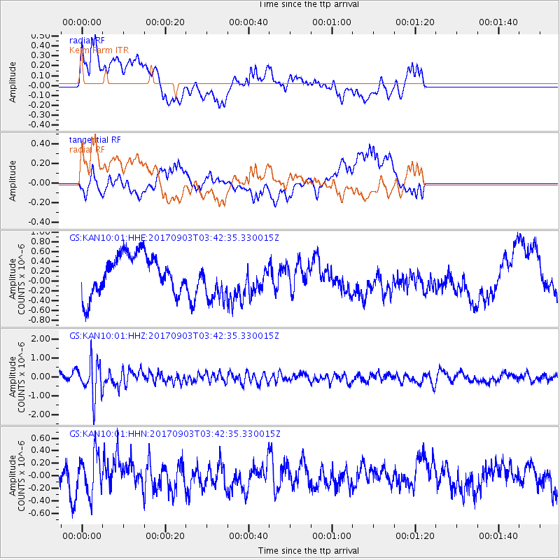
Signal To Noise
| Channel | StoN | STA | LTA |
| GS:KAN10:01:HHZ:20170903T03:42:35.330015Z | 5.359154 | 9.547023E-7 | 1.781442E-7 |
| GS:KAN10:01:HHN:20170903T03:42:35.330015Z | 1.1859612 | 3.2007816E-7 | 2.6988923E-7 |
| GS:KAN10:01:HHE:20170903T03:42:35.330015Z | 1.1741636 | 4.6109878E-7 | 3.92704E-7 |
| Arrivals |
| Ps | |
| PpPs | |
| PsPs/PpSs | |


