You are here: Home > Network List > US - United States National Seismic Network Stations List
> Station MNTX Cornudas Mountains, Texas, USA > Earthquake Result Viewer
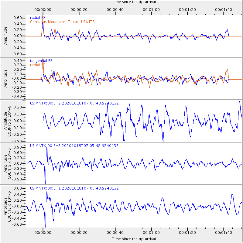
MNTX Cornudas Mountains, Texas, USA - Earthquake Result Viewer
*The percent match for this event was below the threshold and hence no stack was calculated.
| Earthquake location: |
Near Coast Of Northern Peru |
| Earthquake latitude/longitude: |
-3.9/-81.8 |
| Earthquake time(UTC): |
2020/10/18 (292) 06:58:29 GMT |
| Earthquake Depth: |
10 km |
| Earthquake Magnitude: |
5.5 Mww |
| Earthquake Catalog/Contributor: |
NEIC PDE/us |
|
| Network: |
US United States National Seismic Network |
| Station: |
MNTX Cornudas Mountains, Texas, USA |
| Lat/Lon: |
31.70 N/105.38 W |
| Elevation: |
404 m |
|
| Distance: |
41.9 deg |
| Az: |
329.351 deg |
| Baz: |
143.367 deg |
| Ray Param: |
$rayparam |
*The percent match for this event was below the threshold and hence was not used in the summary stack. |
|
| Radial Match: |
57.805515 % |
| Radial Bump: |
375 |
| Transverse Match: |
58.452408 % |
| Transverse Bump: |
400 |
| SOD ConfigId: |
22732711 |
| Insert Time: |
2020-11-01 07:28:45.169 +0000 |
| GWidth: |
2.5 |
| Max Bumps: |
400 |
| Tol: |
0.001 |
|
Signal To Noise
| Channel | StoN | STA | LTA |
| US:MNTX:00:BHZ:20201018T07:05:48.924013Z | 3.7423813 | 4.3623214E-7 | 1.16565396E-7 |
| US:MNTX:00:BH1:20201018T07:05:48.924013Z | 4.078373 | 2.8932675E-7 | 7.094171E-8 |
| US:MNTX:00:BH2:20201018T07:05:48.924013Z | 1.5415637 | 9.66848E-8 | 6.271865E-8 |
| Arrivals |
| Ps | |
| PpPs | |
| PsPs/PpSs | |


