You are here: Home > Network List > AV - Alaska Volcano Observatory Stations List
> Station AMKA Regional Station, Amchitka Island, Alaska > Earthquake Result Viewer
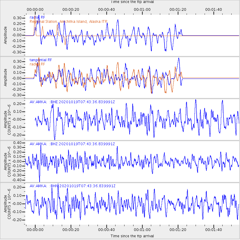
AMKA Regional Station, Amchitka Island, Alaska - Earthquake Result Viewer
*The percent match for this event was below the threshold and hence no stack was calculated.
| Earthquake location: |
Southern Sumatra, Indonesia |
| Earthquake latitude/longitude: |
-3.4/100.3 |
| Earthquake time(UTC): |
2020/10/19 (293) 07:31:28 GMT |
| Earthquake Depth: |
10 km |
| Earthquake Magnitude: |
5.6 Mww |
| Earthquake Catalog/Contributor: |
NEIC PDE/us |
|
| Network: |
AV Alaska Volcano Observatory |
| Station: |
AMKA Regional Station, Amchitka Island, Alaska |
| Lat/Lon: |
51.38 N/179.30 E |
| Elevation: |
116 m |
|
| Distance: |
85.8 deg |
| Az: |
38.094 deg |
| Baz: |
259.334 deg |
| Ray Param: |
$rayparam |
*The percent match for this event was below the threshold and hence was not used in the summary stack. |
|
| Radial Match: |
58.47083 % |
| Radial Bump: |
364 |
| Transverse Match: |
67.81517 % |
| Transverse Bump: |
400 |
| SOD ConfigId: |
22732711 |
| Insert Time: |
2020-11-02 07:33:21.863 +0000 |
| GWidth: |
2.5 |
| Max Bumps: |
400 |
| Tol: |
0.001 |
|
Signal To Noise
| Channel | StoN | STA | LTA |
| AV:AMKA: :BHZ:20201019T07:43:36.839991Z | 2.192187 | 1.5172387E-7 | 6.921119E-8 |
| AV:AMKA: :BHN:20201019T07:43:36.839991Z | 1.0102926 | 7.299436E-8 | 7.225071E-8 |
| AV:AMKA: :BHE:20201019T07:43:36.839991Z | 0.740817 | 6.583933E-8 | 8.8873946E-8 |
| Arrivals |
| Ps | |
| PpPs | |
| PsPs/PpSs | |


