TOBA XU.TOBA - Earthquake Result Viewer
Earthquake location: Eastern New Guinea Reg., P.N.G.
Earthquake latitude/longitude: -6.5/147.4
Earthquake time(UTC): 1997/04/05 (095) 12:23:30 GMT
Earthquake Depth: 69 km
Earthquake Magnitude: 6.1 MB, 6.5 UNKNOWN, 6.4 MW
Earthquake Catalog/Contributor: WHDF/NEIC
Network: XU New Zealand Seismic Experiment
Station: TOBA XU.TOBA
Lat/Lon: 39.23 S/175.54 E
Elevation: 1480 m
Distance: 41.3 deg
Az: 146.3 deg
Baz: 314.772 deg
Ray Param: 0.073658496
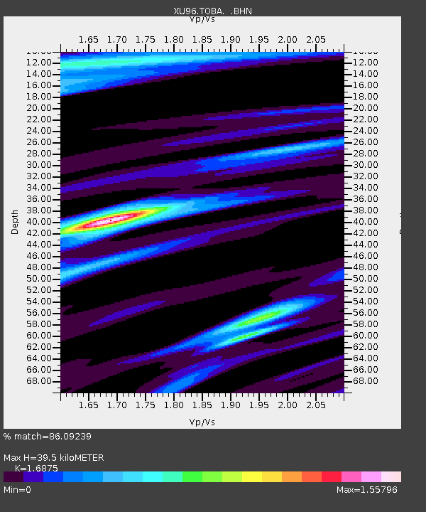
Estimated Moho Depth: 39.5 km
Estimated Crust Vp/Vs: 1.69
Assumed Crust Vp: 6.461 km/s
Estimated Crust Vs: 3.829 km/s
Estimated Crust Poisson's Ratio: 0.23
Radial Match: 86.09239 %
Radial Bump: 400
Transverse Match: 69.8319 %
Transverse Bump: 316
SOD ConfigId: 6273
Insert Time: 2010-03-09 02:04:01.415 +0000
GWidth: 2.5
Max Bumps: 400
Tol: 0.001

Signal To Noise

ChannelStoNSTALTA
XU:TOBA: :BHN:19970405T12:30:38.850006Z1.44381841.3638469E-69.4461103E-7
XU:TOBA: :BHE:19970405T12:30:38.850006Z3.10882382.2321722E-67.1801185E-7
XU:TOBA: :BHZ:19970405T12:30:38.850006Z4.4657323.2790754E-67.3427503E-7
Arrivals
Ps4.5 SECOND
PpPs15 SECOND
PsPs/PpSs20 SECOND