You are here: Home > Network List > IU - Global Seismograph Network (GSN - IRIS/USGS) Stations List
> Station PMG Port Moresby, New Guinea > Earthquake Result Viewer
PMG Port Moresby, New Guinea - Earthquake Result Viewer
*The percent match for this event was below the threshold and hence no stack was calculated.
| Earthquake location: |
Southern Sumatra, Indonesia |
| Earthquake latitude/longitude: |
-3.4/100.3 |
| Earthquake time(UTC): |
2020/10/19 (293) 07:47:20 GMT |
| Earthquake Depth: |
10 km |
| Earthquake Magnitude: |
5.5 Mww |
| Earthquake Catalog/Contributor: |
NEIC PDE/us |
|
| Network: |
IU Global Seismograph Network (GSN - IRIS/USGS) |
| Station: |
PMG Port Moresby, New Guinea |
| Lat/Lon: |
9.40 S/147.16 E |
| Elevation: |
90 m |
|
| Distance: |
46.9 deg |
| Az: |
99.661 deg |
| Baz: |
274.169 deg |
| Ray Param: |
$rayparam |
*The percent match for this event was below the threshold and hence was not used in the summary stack. |
|
| Radial Match: |
92.995384 % |
| Radial Bump: |
304 |
| Transverse Match: |
77.02455 % |
| Transverse Bump: |
400 |
| SOD ConfigId: |
22732711 |
| Insert Time: |
2020-11-02 07:51:50.185 +0000 |
| GWidth: |
2.5 |
| Max Bumps: |
400 |
| Tol: |
0.001 |
|
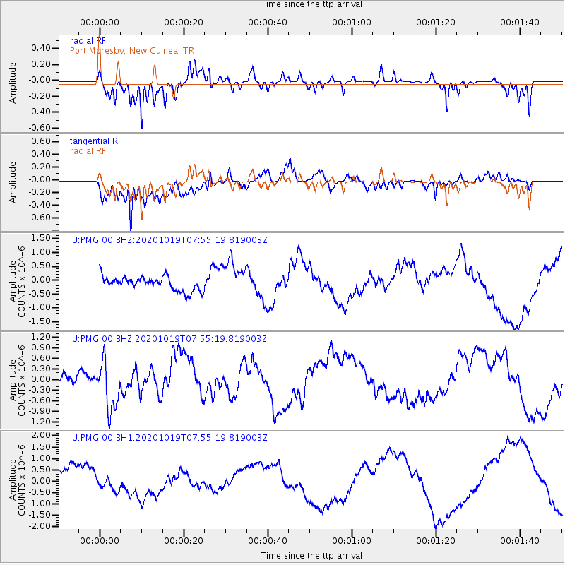
Signal To Noise
| Channel | StoN | STA | LTA |
| IU:PMG:00:BHZ:20201019T07:55:19.819003Z | 4.120908 | 6.891077E-7 | 1.672223E-7 |
| IU:PMG:00:BH1:20201019T07:55:19.819003Z | 0.58570546 | 2.8383178E-7 | 4.8459816E-7 |
| IU:PMG:00:BH2:20201019T07:55:19.819003Z | 2.6154602 | 6.520078E-7 | 2.492899E-7 |
| Arrivals |
| Ps | |
| PpPs | |
| PsPs/PpSs | |


