You are here: Home > Network List > GS - US Geological Survey Networks Stations List
> Station OK051 E0350 and S34600 Roads, Ralston, OK > Earthquake Result Viewer
OK051 E0350 and S34600 Roads, Ralston, OK - Earthquake Result Viewer

| Earthquake location: |
South Of Alaska |
| Earthquake latitude/longitude: |
54.7/-159.6 |
| Earthquake time(UTC): |
2020/10/19 (293) 20:54:40 GMT |
| Earthquake Depth: |
41 km |
| Earthquake Magnitude: |
7.4 Mi |
| Earthquake Catalog/Contributor: |
NEIC PDE/at |
|
| Network: |
GS US Geological Survey Networks |
| Station: |
OK051 E0350 and S34600 Roads, Ralston, OK |
| Lat/Lon: |
36.51 N/96.84 W |
| Elevation: |
263 m |
|
| Distance: |
45.9 deg |
| Az: |
86.482 deg |
| Baz: |
313.972 deg |
| Ray Param: |
0.07092044 |
| Estimated Moho Depth: |
41.5 km |
| Estimated Crust Vp/Vs: |
1.76 |
| Assumed Crust Vp: |
6.483 km/s |
| Estimated Crust Vs: |
3.678 km/s |
| Estimated Crust Poisson's Ratio: |
0.26 |
|
| Radial Match: |
98.36345 % |
| Radial Bump: |
345 |
| Transverse Match: |
92.92428 % |
| Transverse Bump: |
400 |
| SOD ConfigId: |
22732711 |
| Insert Time: |
2020-11-02 21:04:41.400 +0000 |
| GWidth: |
2.5 |
| Max Bumps: |
400 |
| Tol: |
0.001 |
|
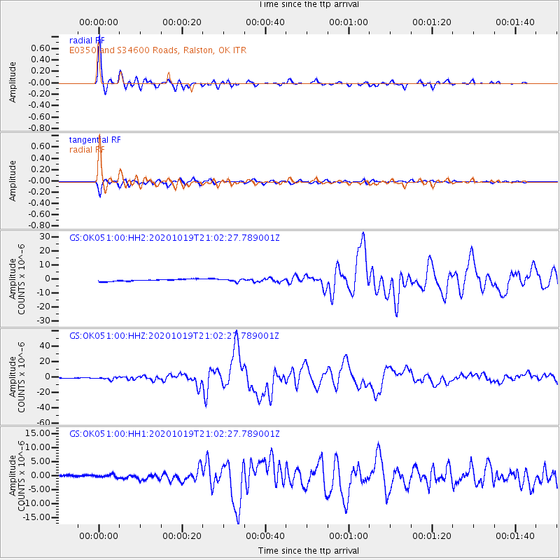
Signal To Noise
| Channel | StoN | STA | LTA |
| GS:OK051:00:HHZ:20201019T21:02:27.789001Z | 10.882825 | 1.6061595E-6 | 1.4758663E-7 |
| GS:OK051:00:HH1:20201019T21:02:27.789001Z | 1.5604568 | 5.5879485E-7 | 3.5809697E-7 |
| GS:OK051:00:HH2:20201019T21:02:27.789001Z | 1.330167 | 9.377953E-7 | 7.050207E-7 |
| Arrivals |
| Ps | 5.2 SECOND |
| PpPs | 17 SECOND |
| PsPs/PpSs | 22 SECOND |


