You are here: Home > Network List > US - United States National Seismic Network Stations List
> Station MVCO Mesa Verde, Colorado, USA > Earthquake Result Viewer
MVCO Mesa Verde, Colorado, USA - Earthquake Result Viewer

| Earthquake location: |
South Of Alaska |
| Earthquake latitude/longitude: |
54.7/-159.6 |
| Earthquake time(UTC): |
2020/10/19 (293) 20:54:40 GMT |
| Earthquake Depth: |
41 km |
| Earthquake Magnitude: |
7.4 Mi |
| Earthquake Catalog/Contributor: |
NEIC PDE/at |
|
| Network: |
US United States National Seismic Network |
| Station: |
MVCO Mesa Verde, Colorado, USA |
| Lat/Lon: |
37.21 N/108.50 W |
| Elevation: |
2170 m |
|
| Distance: |
38.6 deg |
| Az: |
95.347 deg |
| Baz: |
313.573 deg |
| Ray Param: |
0.07539231 |
| Estimated Moho Depth: |
39.75 km |
| Estimated Crust Vp/Vs: |
2.05 |
| Assumed Crust Vp: |
6.476 km/s |
| Estimated Crust Vs: |
3.155 km/s |
| Estimated Crust Poisson's Ratio: |
0.34 |
|
| Radial Match: |
92.83609 % |
| Radial Bump: |
400 |
| Transverse Match: |
77.98663 % |
| Transverse Bump: |
400 |
| SOD ConfigId: |
22732711 |
| Insert Time: |
2020-11-02 21:22:14.445 +0000 |
| GWidth: |
2.5 |
| Max Bumps: |
400 |
| Tol: |
0.001 |
|
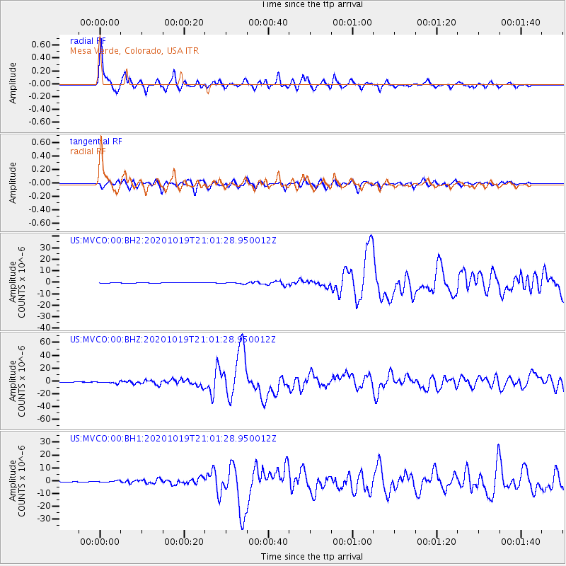
Signal To Noise
| Channel | StoN | STA | LTA |
| US:MVCO:00:BHZ:20201019T21:01:28.950012Z | 14.082187 | 1.540386E-6 | 1.09385425E-7 |
| US:MVCO:00:BH1:20201019T21:01:28.950012Z | 5.5692716 | 5.8318756E-7 | 1.04715234E-7 |
| US:MVCO:00:BH2:20201019T21:01:28.950012Z | 3.3512518 | 6.5354095E-7 | 1.9501398E-7 |
| Arrivals |
| Ps | 6.9 SECOND |
| PpPs | 18 SECOND |
| PsPs/PpSs | 24 SECOND |


