You are here: Home > Network List > US - United States National Seismic Network Stations List
> Station SDCO Great Sand Dunes National Park, Colorado, USA > Earthquake Result Viewer
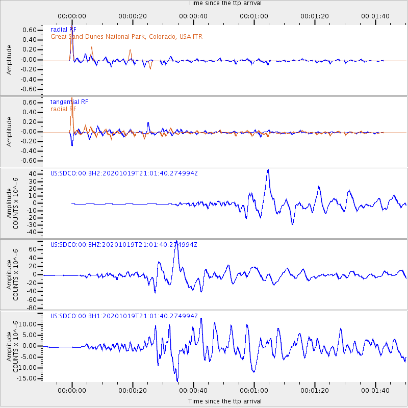
SDCO Great Sand Dunes National Park, Colorado, USA - Earthquake Result Viewer

| Earthquake location: |
South Of Alaska |
| Earthquake latitude/longitude: |
54.7/-159.6 |
| Earthquake time(UTC): |
2020/10/19 (293) 20:54:40 GMT |
| Earthquake Depth: |
41 km |
| Earthquake Magnitude: |
7.4 Mi |
| Earthquake Catalog/Contributor: |
NEIC PDE/at |
|
| Network: |
US United States National Seismic Network |
| Station: |
SDCO Great Sand Dunes National Park, Colorado, USA |
| Lat/Lon: |
37.75 N/105.50 W |
| Elevation: |
2569 m |
|
| Distance: |
40.0 deg |
| Az: |
92.154 deg |
| Baz: |
312.918 deg |
| Ray Param: |
0.07455758 |
| Estimated Moho Depth: |
43.25 km |
| Estimated Crust Vp/Vs: |
1.60 |
| Assumed Crust Vp: |
6.316 km/s |
| Estimated Crust Vs: |
3.941 km/s |
| Estimated Crust Poisson's Ratio: |
0.18 |
|
| Radial Match: |
98.76145 % |
| Radial Bump: |
235 |
| Transverse Match: |
96.493744 % |
| Transverse Bump: |
319 |
| SOD ConfigId: |
22732711 |
| Insert Time: |
2020-11-02 21:22:24.982 +0000 |
| GWidth: |
2.5 |
| Max Bumps: |
400 |
| Tol: |
0.001 |
|
Signal To Noise
| Channel | StoN | STA | LTA |
| US:SDCO:00:BHZ:20201019T21:01:40.274994Z | 5.782174 | 1.3644029E-6 | 2.3596711E-7 |
| US:SDCO:00:BH1:20201019T21:01:40.274994Z | 2.2311265 | 4.0947268E-7 | 1.8352733E-7 |
| US:SDCO:00:BH2:20201019T21:01:40.274994Z | 2.6379077 | 6.128102E-7 | 2.3230919E-7 |
| Arrivals |
| Ps | 4.4 SECOND |
| PpPs | 17 SECOND |
| PsPs/PpSs | 21 SECOND |


