You are here: Home > Network List > G - GEOSCOPE Stations List
> Station MPG Montagne des Peres, French Guyana > Earthquake Result Viewer
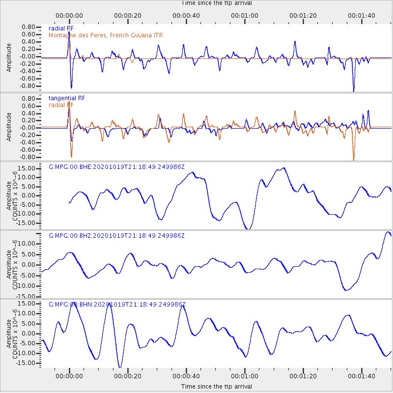
MPG Montagne des Peres, French Guyana - Earthquake Result Viewer
*The percent match for this event was below the threshold and hence no stack was calculated.
| Earthquake location: |
South Of Alaska |
| Earthquake latitude/longitude: |
54.4/-159.6 |
| Earthquake time(UTC): |
2020/10/19 (293) 21:05:57 GMT |
| Earthquake Depth: |
27 km |
| Earthquake Magnitude: |
5.8 mb |
| Earthquake Catalog/Contributor: |
NEIC PDE/us |
|
| Network: |
G GEOSCOPE |
| Station: |
MPG Montagne des Peres, French Guyana |
| Lat/Lon: |
5.11 N/52.64 W |
| Elevation: |
147 m |
|
| Distance: |
95.6 deg |
| Az: |
73.184 deg |
| Baz: |
325.842 deg |
| Ray Param: |
$rayparam |
*The percent match for this event was below the threshold and hence was not used in the summary stack. |
|
| Radial Match: |
57.528152 % |
| Radial Bump: |
400 |
| Transverse Match: |
22.528307 % |
| Transverse Bump: |
400 |
| SOD ConfigId: |
22732711 |
| Insert Time: |
2020-11-02 21:29:44.042 +0000 |
| GWidth: |
2.5 |
| Max Bumps: |
400 |
| Tol: |
0.001 |
|
Signal To Noise
| Channel | StoN | STA | LTA |
| G:MPG:00:BHZ:20201019T21:18:49.249986Z | 2.309016 | 4.872337E-6 | 2.1101357E-6 |
| G:MPG:00:BHN:20201019T21:18:49.249986Z | 3.0758324 | 1.2745176E-5 | 4.143651E-6 |
| G:MPG:00:BHE:20201019T21:18:49.249986Z | 3.3863902 | 9.83157E-6 | 2.9032597E-6 |
| Arrivals |
| Ps | |
| PpPs | |
| PsPs/PpSs | |


