You are here: Home > Network List > GS - US Geological Survey Networks Stations List
> Station OK051 E0350 and S34600 Roads, Ralston, OK > Earthquake Result Viewer
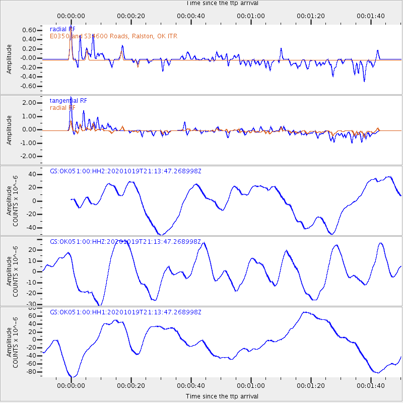
OK051 E0350 and S34600 Roads, Ralston, OK - Earthquake Result Viewer
*The percent match for this event was below the threshold and hence no stack was calculated.
| Earthquake location: |
South Of Alaska |
| Earthquake latitude/longitude: |
54.4/-159.6 |
| Earthquake time(UTC): |
2020/10/19 (293) 21:05:57 GMT |
| Earthquake Depth: |
27 km |
| Earthquake Magnitude: |
5.8 mb |
| Earthquake Catalog/Contributor: |
NEIC PDE/us |
|
| Network: |
GS US Geological Survey Networks |
| Station: |
OK051 E0350 and S34600 Roads, Ralston, OK |
| Lat/Lon: |
36.51 N/96.84 W |
| Elevation: |
263 m |
|
| Distance: |
45.9 deg |
| Az: |
86.235 deg |
| Baz: |
313.648 deg |
| Ray Param: |
$rayparam |
*The percent match for this event was below the threshold and hence was not used in the summary stack. |
|
| Radial Match: |
55.25856 % |
| Radial Bump: |
400 |
| Transverse Match: |
60.045803 % |
| Transverse Bump: |
400 |
| SOD ConfigId: |
22732711 |
| Insert Time: |
2020-11-02 21:30:46.730 +0000 |
| GWidth: |
2.5 |
| Max Bumps: |
400 |
| Tol: |
0.001 |
|
Signal To Noise
| Channel | StoN | STA | LTA |
| GS:OK051:00:HHZ:20201019T21:13:47.268998Z | 2.1496074 | 1.5305364E-5 | 7.120074E-6 |
| GS:OK051:00:HH1:20201019T21:13:47.268998Z | 3.1771245 | 8.831904E-5 | 2.7798418E-5 |
| GS:OK051:00:HH2:20201019T21:13:47.268998Z | 4.304268 | 5.345548E-5 | 1.241918E-5 |
| Arrivals |
| Ps | |
| PpPs | |
| PsPs/PpSs | |


