You are here: Home > Network List > US - United States National Seismic Network Stations List
> Station MIAR Mount Ida, Arkansas, USA > Earthquake Result Viewer
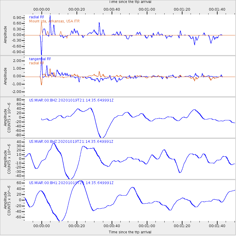
MIAR Mount Ida, Arkansas, USA - Earthquake Result Viewer
*The percent match for this event was below the threshold and hence no stack was calculated.
| Earthquake location: |
South Of Alaska |
| Earthquake latitude/longitude: |
54.5/-159.7 |
| Earthquake time(UTC): |
2020/10/19 (293) 21:06:20 GMT |
| Earthquake Depth: |
26 km |
| Earthquake Magnitude: |
5.7 mb |
| Earthquake Catalog/Contributor: |
NEIC PDE/us |
|
| Network: |
US United States National Seismic Network |
| Station: |
MIAR Mount Ida, Arkansas, USA |
| Lat/Lon: |
34.55 N/93.58 W |
| Elevation: |
207 m |
|
| Distance: |
49.2 deg |
| Az: |
85.6 deg |
| Baz: |
315.217 deg |
| Ray Param: |
$rayparam |
*The percent match for this event was below the threshold and hence was not used in the summary stack. |
|
| Radial Match: |
74.401665 % |
| Radial Bump: |
400 |
| Transverse Match: |
78.398445 % |
| Transverse Bump: |
400 |
| SOD ConfigId: |
22732711 |
| Insert Time: |
2020-11-02 21:57:05.172 +0000 |
| GWidth: |
2.5 |
| Max Bumps: |
400 |
| Tol: |
0.001 |
|
Signal To Noise
| Channel | StoN | STA | LTA |
| US:MIAR:00:BHZ:20201019T21:14:35.649991Z | 1.7630173 | 1.075352E-5 | 6.0994976E-6 |
| US:MIAR:00:BH1:20201019T21:14:35.649991Z | 1.3062438 | 1.9180292E-5 | 1.4683546E-5 |
| US:MIAR:00:BH2:20201019T21:14:35.649991Z | 4.2957907 | 6.7759654E-5 | 1.57735E-5 |
| Arrivals |
| Ps | |
| PpPs | |
| PsPs/PpSs | |


